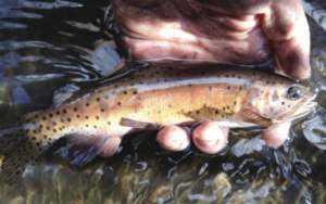
Category Archives: Trout and Salmon

Thank a Beaver for Your Trout Stream

Thank a Beaver for Your Trout Stream

Making trout habitat with fake beaver dams


Beaver dam analog: mimicking the real thing
by Toner Mitchell, Trout Unlimited
from
The Fishing Wire

I recently visited a tailwater stream known for its capacity to produce lots of brown trout, some of them quite large. The reservoir feeding this stream is operated exclusively for downstream agricultural users, the result of which is that the fishery is also renowned for its poor conditions in winter, when dam releases are curtailed and the stream becomes a thin vein of shallow puddles, trickles, and exposed spawning redds. Since this stream is in the coldest corner of New Mexico, anchor ice is common.

I was pleased to see the latest work of the beaver population, knowing that their ponds would provide winter refuge for fish. But I was there to see the leveling device (beaver deceiver) installed by the New Mexico Game and Fish department to mitigate the legitimate though misplaced concern of downstream irrigators, who felt that the beavers were holding back valuable water from ranches and farms. The deceiver was working as intended, sending water downstream while limiting the pond’s depth and expanse so as not to inundate an adjacent parking lot.

My next stop was a nearby fly shop. I proudly reported my observations to the proprietor, who proceeded to give me an earful. The stretch of stream occupied by the beavers had always been a money spot for his guides and their clients. Until, that is, the beavers took up residence. The pond had since become a bugless sucker hole devoid of trout, and though he acknowledged the positive impact of the beaver impoundment on riparian storage and late season flows, the shop owner judged the local beavers as a net detriment to the fishery. Beavers are either good or bad, he opined, never both.

The beaver is a keystone species, generally defined as an organism that exerts an outsized influence on the function and even formation of an ecosystem. Beaver dams capture peak flows, prolong spring runoff, while supporting and extending baseflows with water stored in riparian aquifers. Their deep ponds concentrate nutrients and macroinvertebrates; they provide shelter and security for trout, especially in winter.

Understandably, the perceived downside of beavers comes with the keystone package. Like wolves, another disproportionately influential animal, beavers disrupt on a landscape scale. They not only plug up streams, but ditches, culverts, and bridges. Their dams inundate yards, fields, and pastures used by livestock and campers. Beavers kill and eat prized trees. The disgruntled fly shop owner hypothesized that his favorite run-turned-hated-beaver-pond might have warmed too much to harbor the trout it once did and, along with possibly consuming too much oxygen, accumulated silt may have buried insect production.

For what little it’s worth, I’ve personally witnessed few instances where beavers have negatively impacted trout. I don’t doubt that it happens, certainly not in this case, but I think such stories should be viewed in the broader context of watershed health. Consider how many of our highest quality fisheries (and grazing pastures) were literally made by beavers. They cleared trees to build their dams, which filled with trapped sediment and forced channel migration across floodplains. Over time, floodplains expanded and thickened thanks to further beaver-induced sediment deposition. This long process created thick, spongy meadows, essentially grass-skinned reservoirs feeding streams with cooled groundwater.

In addition to logging, mining, grazing, floodplain development, and road building, our large scale beaver extirpation in the late 1800s contributed greatly to watershed degradation. Without beavers, natural and man-made “nick points” went unrepaired, leading to channel incision and headcutting. By armoring and straightening streams for flood control, we actually intensified flooding by concentrating flow and increasing its cutting force. As a result, our beaver-created meadow reservoirs have been drying from within for many decades.

As climate change tightens its unpredictable yet certain grip on our landscapes, it falls on us, the ultimate keystone species, to restore the land’s capacity to absorb disturbance while maintaining function. To hedge against drought, we must lift and spread water tables and reconnect streams with their floodplains, especially in headwater regions. Reconnected floodplains will also enable our streams to de-energize high intensity precipitation events, particularly important in this era of common wildfire.

Where beavers live, we must make them welcome, as they are the cheapest and most efficient means of restoring the greatest acreage of watershed in the shortest timeframe. They work around the clock and accept food as payment; no matter how hard we try, we will never find a better deal than that.

And where they don’t live, we must imitate them; thanks to conservation groups in New Mexico, including the Truchas Chapter of TU, imitating beavers may soon become the hottest trend in stream restoration. Volunteer-made beaver dam analogs (BDAs) employ natural materials and are designed to pass water, trap sediment, and raise riparian water tables. Combined with willow and cottonwood plantings, which provide stream shading and future beaver food, BDAs create true beaver habitat and often attract the real animals to continue this important work.

As a wise man I know once said, “In times of flood, prepare for drought. In drought, prepare for flood.” I’m not sure, but I think this guy may have been a beaver in a previous life.

Toner Mitchell is TU’s New Mexico Water and Habitat Program coordinator for New Mexico.

Read more from T.U. at www.tu.org.

Trout Unlimited New Science Promotes Trout Recovery

New Science Promotes Trout Recovery

By Chris Wood, CEO/President
Trout Unlimited
from The Fishing Wire

Some define conservation as overseeing loss. Loss of wetlands; loss of open space; loss of water quality; loss of species. Aldo Leopold harkened to this when he wrote in the Sand County Almanac that “One of the penalties of an ecological education is that one lives alone in a world of wounds. Much of the damage inflicted on land is quite invisible to laymen. An ecologist must either harden his shell and make believe that the consequences of science are none of his business, or he must be the doctor who sees the marks of death in a community that believes itself well and does not want to be told otherwise.”

One of the things that Trout Unlimited does so well is to re-frame the question of overseeing loss to one of advancing recovery. Trout and salmon are remarkably resilient creatures. They have survived for millennia, and if given half a chance will respond to restoration. This fact makes a new tool developed by TU scientists and university, state and federal partners so exciting.

Almost every western native trout, and many forms of Pacific salmon and steelhead have been proposed or are listed for protection under the Endangered Species Act (ESA). The historic focus of the ESA is to keep species from becoming extinct. Because resources are so limited, when recovery efforts do occur they often lack the data necessary to evaluate extinction risks and the benefits of management activities based on quantitative information.

Thanks to a grant from NASA, TU scientists, working with universities and state and federal partners, developed a new method of looking across broad landscapes to make informed judgments about where extinction is likely to occur, and how to take concrete steps to improve the security of existing populations and, in some cases, enable successful reintroductions.

Lahonan cutthroat trout, listed as threatened under the Endangered Species Act, are coming back to their native watersheds thanks state-of-the-art techniques used by TU scientists to map and model suitable habitat.
The scientists aggregated 30 years worth of data on Lahontan cutthroat trout—a threatened species under the ESA—across all 211 streams where Lahontans exist, or historically existed, into a searchable database. They then developed advanced modeling and mapping techniques to 1) evaluate extinction risks for Lahontans in each occupied water; 2) evaluate the benefits of removing non-native trout from these streams; and 3) evaluate the likely success of reintroducing Lahontans into waters where they previously existed.

Importantly, they have developed a population simulator that allows partners with fish and wildlife agencies from Nevada, Oregon and California, the Forest Service, Bureau of Land Management, and the U.S. Fish and Wildlife Service to see the model results and explore impacts of various management actions in terms of how they decrease extinction risks. An equally broad array of partners is looking to use a similar recovery planning tool under development for Bonneville cutthroat trout and redband trout—two other imperiled native trout species.

The scientists call the new approach the Multiple Population Viability Analysis—MPVA. Its wonky name aside it is a game-changing innovation that will allow state and federal agencies and organizations such as TU to begin to think less about overseeing loss and more about recovering imperiled native trout species across broad landscapes. That is incredibly exciting and in keeping with the fact that conservation is not about overseeing loss. Conservation—the notion that we can take specific actions today to leave our children a healthier world—is the single most affirmative, optimistic idea that America ever gave the rest of the world.

Chris Wood is the president and CEO of Trout Unlimited. He lives in Washington, D.C., and works from TU’s Arlington, Va., headquarters.

Read more about Trout Unlimited

What Is the Lahontan Cutthroat?

Bringing Back the Lahontan Cutthroat

By Helen Neville
Senior Scientist, Trout Unlimited
from Griffin Daily News

Do you know this trout?


I think it’s safe to say that rarely in my life have I been inspired performing grant reporting. But in a recent effort to compile progress toward metrics for the National Fish and Wildlife Foundation’s Lahontan Cutthroat Trout Keystone Initiative, which funds much of TU’s work on LCT, I had one of those wonderful “Wow!” moments in seeing—distilled into just a few numbers—what TU has been able to bring to the table for LCT conservation since the Initiative’s inception in 2010.

Back then, NFWF approached me to help develop a “Business Plan” to establish this new funding initiative, because they felt that the federally threatened Lahontan cutthroat trout was one at-risk trout where additional strategic funding could foster collaboration and innovation to help move the needle toward effective conservation (spoiler alert: they were right). I first worked with TU’s Amy Haak to apply the Portfolio approach she and Jack Williams had refined for inland trout to be certain we enveloped important aspects of LCT diversity, and pulled together the primary agency, university and tribal partners involved in LCT management and research to detail threats, goals and strategies for the business plan.

Once the LCT Keystone Initiative was established, I coalesced this group into a steering committee to ensure that proposals under the program hold true to the business plan and match the LCT recovery teams’ priorities. We quickly hit on an efficient and productive model where we, the steering committee, prioritize needs each year and TU writes ‘core grants’ requesting funding for all the needs in one proposal—some of the funding relates to TU’s work while much is given out to partners, but all meets the steering committee’s collective priorities for LCT conservation needs.

When I came to TU in 2006 after having completed my graduate work on LCT, I served on one of four LCT management teams (GMUs/RITs for Geographic Management Unit Teams or Recovery Implementation Teams, depending on the geography) and TU’s relationships with the LCT agencies weren’t always good. In fact, TU had previously threatened to sue over the declining state of the fish. But this collaborative process has since built a tremendous amount of trust and synergy, pushing us all to think creatively on how to get good things done for the fish—because, of course, that is the goal we all agree on.

For instance, a key need that had been identified by the agencies was developing safe harbor agreements with private landowners; these agreements provide legal assurances for landowners that encourage them to allow us to reintroduce Lahontan cutthroats to their lands. One of the steering committee’s first actions, then, was to ask for NFWF support for TU to fund a new position at the Nevada Department of Wildlife for a dedicated Lahontan cutthroat trout safe harbors biologist. The resulting private land agreements have enabled some of our most ambitious recovery work on stream-form LCT (see below).

As another example, we’d often hear from state agencies, “we would love to do that (field project) but don’t have the resources on the ground”. So, we started requesting funding for an annual ‘range-wide field crew,’ with an unusual twist: the crew is hired and run by TU’s LCT Coordinator Jason Barnes (also NFWF-funded), but their work plan is developed by the steering committee partners and they are loaned out to these partners for prioritized work across the entire range of LCT. Since 2013, they’ve worked for all three state agencies managing LCT (Nevada, California, and Oregon), the Summit Lake Paiute Tribe, The Nature Conservancy, the Forest Service, BLM, and TU; they have helped with baseline biological monitoring for safe harbor agreements in 26 streams, sampled LCT populations in 28 streams, assisted with non-native trout removal in 18 streams, monitored habitat in eight creeks, installed stream temperature thermographs in 39 streams, and sampled for non-native trout environmental DNA (eDNA) in nine streams. With NFWF funding, TU’s California and Sportsmen’s Conservation Project staff have also, among other things, run multiple youth Trout Camps in California and Nevada, undertaken a highly collaborative and successful land protection campaign that opened up new Lahontan opportunities, and outreached to thousands of people including students and veterans about LCT. We have funded several LCT displays and “Know Your Natives” day camps at Reno’s Nevada Discovery Center, which serves over 500,000 people a year, helped build barriers to protect several large existing and future metapopulations, and completed and published multiple research projects on LCT – with more in the works – that are guiding conservation planning. We are also now a member of all four LCT Recovery Implementation/Geographic Management Unit teams.

So back to those metrics: what’s the outtake of all this collaboration?

Since 2012, the GMU/RITs have reintroduced LCT to eight historical streams encompassing 65 miles; another 28 miles have been treated and cleared of non-native fish and are waiting for reintroduction/expansion. Because of successful safe harbors agreements, some of these waters include 36 miles of interconnected ‘metapopulation’ habitat, much of which is on private land. We are in the final planning phases for two more metapopulations, which will span 25 and 55 miles each when finished, and we are beginning conversations with key landowners to see if we can’t reconnect two major river basins and join a networked stream system that provides over 100 miles of some of our best LCT habitat.

There’s my “Wow!” moment on what good will, good collaboration, and a lot of hard work can do.

Helen Neville is TU’s senior scientist. She is based in Boise.

Au Sable River

How the Au Sable River Changed the Trout Fishing World
By CASEY WARNER
Michigan Department of Natural Resources
from The Fishing Wire
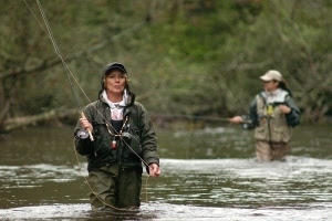
The Au Sable River is known throughout the country as a premier trout-fishing destination.


With the opener of Michigan’s trout season right around the corner, anglers soon will be donning their waders and heading out to one of the thousands of cold, quality streams that make the state a nationally known trout-fishing destination.

Perhaps the most renowned place to cast a fly in Michigan – the Au Sable River, running 138 miles through the northern Lower Peninsula – is significant for much more than its outstanding trout fishing.

In 1959, 16 fishermen, united by their love of trout and the Au Sable River and concerned about the need for long-term conservation of Michigan’s cold-water streams, gathered at George Griffith’s home east of Grayling.

“For some time I and several others have been considering ways and means to protect and preserve trout and trout fishing, and have come up with the idea of forming an organization to be known as Trout, Unlimited,” wrote Griffith, a member of the Michigan Conservation Commission, in an invitation letter to a fellow angler in 1959.

“Such an organization could work with state and federal agencies now charged with that responsibility … it would help educate the public on the dire need of sound, practical, scientific trout management and regulations to protect the trout as well as satisfy fishermen.”

The sportsmen that responded to Griffith’s invitation to meet at his cabin on the Au Sable believed that better and more scientific habitat management would improve the environment as well as the state’s trout population and fishing.

Nearly 60 years after that initial meeting, the organization those fishermen founded – Trout Unlimited – has become a national champion of fish habitat conservation.

Today, the organization has almost 300,000 members and supporters, with 30 offices nationwide, and sponsors the International Trout Congress.

The Michigan History Museum in Lansing is showcasing Trout Unlimited’s founding on the Au Sable in a special exhibition, “The River that Changed the World,” open through July 29.

“The Au Sable River has influenced – and continues to influence – people around the world,” said Mark Harvey, Michigan’s state archivist and the exhibition’s curator. “The stories in the exhibition demonstrate the innovative and unprecedented ways private citizens and state government worked together to conserve and protect the river and sustainably manage its fish populations.”

Original paneling and artifacts from the Wolverine fish car, which carried millions of fish by rail across Michigan, tell museum visitors the story of efforts to plant trout in the Au Sable.

Fred Westerman, one of the first employees of the Wolverine and former fisheries chief in the Michigan Department of Conservation, forerunner to the Michigan Department of Natural Resources, once reported:

“Frequently … thirty cans of fish would be dropped off at some spooky junction – like in the jack pine at Au Sable-Oscoda with the cemetery across the tracks and the depot a mile from town – on the night run of the Detroit & Mackinac, to await the morning train going up the river branch.”

The exhibition also introduces the relationship between the Anishinabe (Odawa and Ojibwe people) and the Au Sable River and explores Grayling as a fishing and tourism hotspot since the mid-19th century.

Harvey said that the idea for the exhibit stemmed from the Michigan History Center’s longstanding relationship with, and eventual donation of materials from, Art Neumann, one of the cofounders of Trout Unlimited and its executive director from 1962 to 1965.

“Instead of just focusing on the Trout Unlimited group, we took a wider view of the river that inspired these people to work for systemic change,” Harvey said.

The exhibition features George Griffith’s 24-foot-long Au Sable river boat and a re-creation of Neumann’s Wanigas Rod Shop, where he made fly rods considered works of art and became known as a champion of conservation.

A “battery” of glass beakers from the Grayling fish hatchery, each of which held thousands of eggs, highlights the late 19th-century work of state conservationists and private citizens who tried to save the Arctic grayling.

An iconic cold-water fish that once dominated northern Michigan streams but was almost extinct by the beginning of the 20th century, Arctic grayling were native only to Michigan and Montana in the lower 48 states.

“When sportsmen first discovered the grayling in the Au Sable, it drew international attention,” Harvey said.

The current Michigan Arctic Grayling Initiative now aims to restore self-sustaining populations of the fish within its historical range in Michigan.

Current DNR Fisheries Chief Jim Dexter applauded the vision and passion of those who recognized the Au Sable’s promise as a premier fishing destination.

“As the name of the exhibit implies, the Au Sable is a world-class fishery resource attracting anglers from every corner of the earth,” Dexter said. “It’s one of the most stable groundwater-influenced watersheds in North America, and produces exceptional trout fishing.

“It wasn’t always that way, though. Without the creation of Trout Unlimited at the Au Sable River, by those who understood the potential of our cold-water resources, Michigan might not be home to one of the world’s greatest trout fisheries.”

Trout Unlimited’s work has also encouraged other groups like the Anglers of the Au Sable, who now lead the charge for preserving this unique, high-quality body of water. Dubbed the “river guardians,” the Anglers group has fought multiple environmental threats to river.

The exhibit and related events also offer opportunities for hands-on experiences.

Visitors can learn how to tie a fly and compare tied flies to real insects under a microscope or sit in a kayak and take a 360-degree virtual reality paddle down the Au Sable.

They can also explore the essence of the Au Sable without leaving mid-Michigan through a series of museum programs revolving around the exhibit.

“While the exhibit focuses on the wonderful stories, images and sounds of the river, we wanted to bring the Au Sable River to the capital region,” said Michigan History Center engagement director Tobi Voigt. “We designed a series of programs highlighting themes from the exhibit – like fly-fishing and kayaking – that can be enjoyed by a variety of age groups. We’re especially excited to showcase a fly-fishing star and host our first-ever kayak tour.”

Programs include a fly-casting workshop with noteworthy fly-tier and fly-fishermen Jeff “Bear” Andrews, a kayak tour on the Red Cedar River, and the Second Saturdays for Families series featuring hands-on activities like making a compass, a sundial or a miniature boat.

To learn more about “A River That Changed the World” and to find Michigan History Museum visitor information, go to www.michigan.gov/museum.

Check out previous “Showcasing the DNR” stories at www.mi.gov/dnrstories. Subscribe to upcoming articles and other DNR publications at the bottom of our webpage at www.mi.gov/dnr.
Can Spawning Fish Influence River Profiles?

Sex that moves mountains: Spawning fish can influence river profiles
By Eric Sorensen, WSU News
from The Fishing Wire

fishPULLMAN, Wash. – It turns out that sex can move mountains.

A Washington State University researcher has found that the mating habits of salmon can alter the profile of stream beds, affecting the evolution of an entire watershed. His study is one of the first to quantitatively show that salmon can influence the shape of the land.

Alex Fremier, lead author of the study and associate professor in the WSU School of the Environment, said female salmon “fluff” soil and gravel on a river bottom as they prepare their nests, or redds. The stream gravel is then more easily removed by flooding, which opens the underlying bedrock to erosion.

“The salmon aren’t just moving sediment,” said Fremier. “They’re changing the character of the stream bed, so when there are floods, the gravel is more mobile.”

Alex Fremier, associate professor at the WSU School of the Environment and author of “Sex that moves mountains” in the journal Geomorphology, with a rainbow trout on Lake Pend Oreille.
The study, “Sex that moves mountains: The influence of spawning fish on river profiles over geologic timescales,” appears in the journal Geomorphology.

Working with colleagues at the University of Idaho and Indiana University, Fremier modeled the changes over 5 million years and saw streams with spawning salmon lowering stream slopes and elevation over time. Land alongside the stream can also get steeper and more prone to erosion.

“Any lowering of the streambed translates upstream to lower the entire landscape,” said Fremier.

Different salmon species can have different effects, Fremier said. Chinook salmon can move bigger pieces of material, while coho tend to move finer material. Over time, this diversification can lead to different erosion rates and changes to the landscape.

The paper is another way of looking at the role of living things in shaping their nonliving surroundings. Trees prevent landslides; beavers build dams that slow water, creating wetlands, flood plains and habitats for different trees and animals.

In 2012, researchers writing in Nature Geoscience described how, before the arrival of trees more than 300 million years ago, landscapes featured broad, shallow rivers and streams with easily eroded banks. But tree roots stabilized river banks and created narrow, fixed channels and vegetated islands, while log jams helped create the formation of new channels. The new landscape in turn led to “an increasingly diverse array of organisms,” the researchers wrote.

Similarly, said Fremier, salmon can be creating new stream habitats that encourage the rise of new salmon species. On the other hand, streams where salmon drop in number or disappear altogether could see significant long-term changes in their profile and ecology.

“The evolution of a watershed can be influenced by the evolution of a species” Fremier said.

Read more like this at Washington State University News here

Horse and Mule Trout Surveying

Fisheries Work by Horse and Mule Trout Surveying
Today’s feature on back-country trout surveying comes to us from Nebraska Game and Parks.
from The Fishing Wire

Sometimes, if you want to get where the fish are, you have to go where other people are not.

Casey Cary leads the packhorse with survey equipment along the south fork of Soldier Creek. (NEBRASKAland/Justin Haag)
Such was the case for fisheries biologists in the Pine Ridge last week, as they recruited the help of a Game and Parks Commissioner, a Wyoming outfitter, and six four-legged friends to study one of Nebraska’s most remote public fishing areas.

With the help of horses and mules owned by Commissioner Rick Brandt of Roca and outfitter Casey Cary of Powell, Wyoming, fisheries staff members Al Hanson and Joe Rydell of Alliance administered a rare sampling of the south fork of Soldier Creek. The cold-water brook is one of three branches of the stream coursing through the Soldier Creek Wilderness Area before it merges to one and flows eastward to Fort Robinson State Park.

Similar to biologists throughout the state this spring, Hanson and Rydell have been persistently surveying fish populations, usually using trucks and motorboats to set and retrieve nets. The samplings help them make determinations about fisheries, such as populations, size and health of the various species swimming throughout the Panhandle. The Commission uses the information to make management decisions and advise anglers of the best fishing spots.

The biologists use a little different approach for cold-water streams, employing electroshocking equipment to stun fish, slowing them down just enough to be netted for study and then released. Many trout streams in Nebraska may be remote, but most of them are accessible by vehicle at least to some extent.

Brandt and Cary secure the load. (NEBRASKAland/Justin Haag)
Because of wilderness area regulations, surveying the headwaters of Soldier Creek’s south fork is a little more challenging. Wilderness areas, each of which are managed by one of four federal land management agencies (in this case, the U.S. Forest Service), have special rules to limit negative impacts from humans and ensure their preservation. The rules allow for no mechanized vehicles, including bicycles, game carts or even trucks driven by fisheries biologists. Horses, however, are permitted, and, for this fisheries project, hooves would have to be involved.

The survey party of four, along with this writer-photographer, rode on the backs of Brandt and Cary’s horses and mules for the seven-mile round trip while a packhorse carried the survey equipment. Included in the panniers and strapped to the saddle were long-handled nets and the electroshocking backpack unit with its wands. The unit, which looks similar to a metal detector, sends a non-lethal charge through nearby surrounding water.

Because of his past ventures by mule, Brandt was in familiar territory as the crew made its way up the creek. The avid horseman who owns a Lincoln excavation company was selected to the Commission’s board last year with a reputation for supporting big game conservation efforts, most notably Nebraska’s bighorn sheep program. He is one of the founding members of the Nebraska Big Game Society, which has provided financial support for many of the Commission’s conservation efforts for wild sheep, elk and mule deer.

Commissioner Rick Brandt of Roca is an avid horseman who loves riding his mules in the Pine Ridge. (NEBRASKAland/Justin Haag)
At least twice a year Brandt rides the northwestern Nebraska backcountry to catch sight of big rams and other Nebraska wildlife. During those trips, he often also takes a gander in the creeks to see what is swimming in their clear waters. This far up the creek, things are usually pretty quiet.

“I never see footprints up this far,” Brandt said, as he was pointing out some of the best spots for trout. “And I’ve seen some big fish up this way.”

Although a glitch in the backpack unit deterred Hanson and Rydell from surveying as much of the creek as they had planned, they were able to learn plenty.

“We found out what we wanted to know,” Hanson said. “We have some really quality brook trout up here. We also have some big browns and big creek chubs.”

In addition to nice fish, they saw some nice scenery in a landscape painted green with spring rains. With occasional sandstone cliffs, ponderosa pine trees and a variety of hardwoods towering above, the south fork meanders over a bed of stones with areas of shallow rapids between deeper slower-moving pools. It’s an advantageous situation if you’re a trout.

Al Hanson watches for stunned fish as Joe Rydell runs the electroshocking equipment. (NEBRASKAland/Justin Haag)
“This is some of our best rubble in the Pine Ridge,” Hanson said, as he watched fish dart through the clear water flowing over well-worn rocks at the creek’s headwaters.

Hanson, a longtime employee of the Commission and now fisheries supervisor for the northwest district, has familiarity with the upper third of the south fork, even if he does not get there as often as he would like to. He remembers using a horse and coolers to pack in fingerling brook trout to the upper end of the south fork in the 1980s and again in 1993. The latter stocking followed the flood of 1991, in which thunderstorm deluged the area with 12 inches of rain and was suspected to be detrimental for the brook trout population.

From last week’s observations, it appears the trout are naturally reproducing in the creek and doing well.

The upper end of the south fork of Soldier Creek may not be the easiest place to access, but few who have been there regret the journey – especially those who get there with the help of some hooves.

Catch More Tailwater Trout

Trout’s Fly Fishing- 5 Ways to Catch More Tailwater Trout
By: Kyle Wilkinson, Trout’s Fly Fishing Marketing and Brand Manager
from The Fishing Wire

Whether we like it or not- Winter is here. That pretty much gives us two choices- quit fishing, or keep fishing. I’m always of the opinion to ‘keep fishing’. One of the best parts about living in Colorado- and particularly on the Front Range- is the abundance of Tailwater fisheries that lie within an easy drive of our homes. That said, I still believe many anglers aren’t catching as many fish as they should be. If you’ve ever found yourself struggling with your success on winter tailwaters, give these 5 tips a try next time you decide to bundle up and get the boots wet in the months to come:

1. Use Yarn- many of you reading this may have heard this recommendation before, but it bears repeating. I feel that strongly about it. Simply put, yarn indicators are WAY more sensitive than plastic bobber-style indicators. Fish this time of year can be pretty lethargic (compared to summer) and typically won’t eat your flies with much aggression. Oftentimes your yarn won’t even dunk underwater but rather just ‘pause’ or ‘lean over’ when a fish strikes. If you’ve never used yarn indicators before, be prepared to be amazed with the sensitivity you’ll get. Side note- tips for yarn success- carry several and liberally apply some fly floatant before starting the day. Be prepared to dry off your indicator every couple hours and reapply. If you decide that your indicator is too waterlogged after a few hours, simply swap it out for a fresh one. While I realize these do require a little more maintenance than a thingamabobber, the fact that it leads to more fish in the net throughout the day is always worth it to me.

2. Putty and Split Shot- if you’re not using both split shot AND putty, you’re really missing out. Flows are at their lowest levels of the year and being able to dial in the weight on your nymph rigs is paramount to success. Any of the commercially made tungsten putties will work great so don’t get too caught up on which ‘brand’ to buy. Here’s how I put both split shot and putty to use for me this time of year. To start, select the size of split shot that will get you by in the shallowest water you’ll be fishing. Anytime you come to deeper water, simply pull out a little putty and apply it directly on top of the split shot, rolling it into a nice round ball. Voila. That’s it! Throughout the day you can add and remove putty as necessary to make sure you’re always getting your flies right down into the fishes faces. When you decide you need to take off a little (or all) of the putty you added, simply peel it off and place back in the original container. You can use and reuse tungsten putty for months on end before running out. The best part of using tungsten putty is that it avoids having to constantly pinch and remove split shot throughout the day. This will help protect your light tippets and is also just a whole heck of a lot faster way to make weight adjustments!

3. Never make a cast standing in the water that you could have made standing on dry ground. This is another HUGE one for me, but is a mistake I see anglers make time and time again. Whenever you approach a likely looking area, always make it a point to fish it while keeping your wading boots on dry ground.

Avoiding splashing around, crunching rocks, and in general- disturbing the water with your steps- is always going to leave the fish feeling much more at ease and in turn- more eager to eat your flies (this rule should actually be applied year round).

4. Tighten up your flies- If you don’t fish your flies spaced closely together during winter, I’m confident you’re missing out on a few fish throughout the day. I always like to say that a wintertime tailwater trout lives in a shoebox. (i.e. if you put a trout in a shoebox, it doesn’t have much room to move side to side). If I’m not getting my flies in this ‘shoebox’ zone, my confidence in getting an eat goes down drastically. My rule for spacing my flies during winter is to make a fist, and then extend my thumb and pink in opposite directions. This is the spacing you should be using- approximately 10″ or so. If you’ve never fished your flies this close together, consider yourself warned- it’s probably going to seem a little weird at first. One thing I can promise you though is that you’re going to need your net more throughout the day if you give it a try!

5. Watch the bubbles- we’ve already talked about indicators and weight, and I firmly believe that one of the biggest reasons people don’t catch as many fish as they should is that they’re simply not getting down to them. Next time your nymphing make sure to keep an eye on the bubbles on the surface. What are they doing? Are they moving the same speed as your indicator? If so, this is a dead giveaway you’re not getting down to the fish. Most fish this time of year are sitting very close to the bottom. The water on the bottom of the river is moving slower than the water on the surface. If you’re indicator is floating the same speed as the bubbles on the surface, this means that you’re not getting down to the fish. Simple as that. The goal is to always have your indicator floating SLOWER than the bubbles on the surface. This can quickly be achieved by adding a little more depth and/or weight to your rig. If you’ve never paid attention to this before I think you’ll be amazed at how much of a difference it makes and how quickly you are now able to dial in your rig, ultimately achieving a perfect drift to the fish!

Trouts Fly Fishing is a full service fly shop located in the heart of Denver, CO between Downtown and Cherry Creek North. A second location was established in Frisco, CO located right on Main St. In addition to selling fly fishing goods, Trouts also offers a wide selection of fly fishing classes, guided trips and destination travel options. Some of their trips include both float fishing and wade fishing on the Blue River, Colorado River, Williams Fork River, Eagle River, Roaring Fork River, Frying Pan and Arkansas River. Trouts has been proudly serving the angling community for over 15 years.

Gila Trout

Gila Trout Swim Mineral Creek
Devastating fire cleared path for rare trout’s return

Craig Springer, USFWS
from The Fishing Wire

Wear and tear on boot soles and a helicopter—that’s what it took to get 1,033 Gila trout safely placed in the remote headwaters of Mineral Creek, well inside the Gila National Forest of southwestern New Mexico.

On November 18, 2016, the U.S. Fish and Wildlife Service (Service) working with its partner agencies, the New Mexico Department of Game and Fish and the U.S. Forest Service, released two age classes of Gila trout into Mineral Creek ranging up to a foot long. The rare yellow trout were spawned, hatched and raised in captivity in 2015 and 2016 at the Service’s Mora National Fish Hatchery. Hatchery fish are carefully paired and spawned to maximize genetic diversity of offspring which provides a safeguard for their survival in the wild. The captive fish also purposely face rigorous swimming conditions in the hatchery to further ensure their fitness when released.

These 1,033 trout traveled by truck eight hours to meet a helicopter at the Gila National Forest’s Glenwood Ranger Station. The aircraft made multiple flights carrying an aerated tank at the end of a long-line, each time full of Gila trout. Biologists from the three agencies had hiked in several miles in the rugged country to meet the trout and place them in the cool, shaded runs and pools of Mineral Creek.

Mineral Creek is tributary to the San Francisco River near Alma, New Mexico. Streams in this watershed harbor one of five known relict genetic lineages of Gila trout. The species lives only in New Mexico and Arizona along the Mogollon Rim, an area of conservation emphasis for the Service. This release is a large step forward in conserving Gila trout, noted Andy Dean, lead Gila trout biologist with the Service’s New Mexico Fish and Wildlife Conservation Office, based in Albuquerque. “This repatriation into Mineral Creek adds another stream to harbor Gila trout, as outlined as a necessity in the Gila Trout Recovery Plan,” said Dean. “Not only does this add a population within the San Francisco River drainage, it also helps establish Gila trout populations across a larger geographical area. More Gila trout over a larger area adds greater security to this rare fish.”

That desired security will be achieved when the Mineral Creek population is naturally reproducing, and multiple year classes swim its waters, perhaps in 2018.

Mineral Creek came to the attention of biologists as a candidate stream to receive Gila trout following the massive Whitewater-Baldy Fire of 2012. Destructive as it was, the forest fire made Mineral Creek suitable for Gila trout. The fire burned in the headlands of the stream and summer rains washed a slurry of ash and debris down its course, removing unwanted competing non-native fishes. Though the mountain slopes and streamside vegetation are not fully stabilized post-fire, sufficient habitat exists to harbor Gila trout in Mineral Creek. With so few suitable streams available to repatriate Gila trout, biologists seized the opportunity.

Mineral Creek Canyon is steep to be sure. It’s certainly among the more remote and more difficult Gila trout habitats to reach, but it’s not the only stream to receive Gila trout from Mora National Fish Hatchery this autumn. Another 8,621 Gila trout have been placed in several other waters that advance the species’ recovery and should entice anglers to go after native trout in native habitats of southwest New Mexico.

Willow Creek received 3,039 Gila trout; Gilita Creek, 1,022; Sapillo Creek, 2,270; and West Fork Gila River, 2,290. These waters are readily accessible and won’t require shedding lots of boot tread to reach them as is the case with Mineral Creek. These trout—shards of sunshine—lie in dark water behind boulders and in the scour pools beneath log jams, waiting for bugs to come drifting by. They also wait for what anglers may throw their way. Anglers should visit the New Mexico Department of Game and Fish website to learn more about fishing regulations, which requires a free Gila trout permit.

The Gila trout is protected under the Endangered Species Act. The species was listed as endangered in 1973, and through conservation measures it was downlisted to threatened in 2006. A year later select Gila trout populations were opened to angling for the first time in 50 years.

To learn more visit www.fws.gov/southwest

Craig Springer, External Affairs, U.S. Fish and Wildlife Service-Southwest Region

How Do Beavers Engineer Better Fish Habitat?

Oregon beavers engineer better fish habitat, more fish

After four years, scientists recorded a 175 percent increase in juvenile steelhead

Contributed by Michael Milstein
from The Fishing Wire

An ecological experiment that employed beavers to restore streams in Central Oregon found that the streams produced nearly twice as many juvenile steelhead within a few years after the beavers went to work.

While beavers’ natural engineering abilities are well-known, the project on Oregon’s Bridge Creek is the first to show that their reengineering of streams can yield such pronounced improvements in fish populations. The results suggest that, under the right conditions, beavers can restore the health of streams and their fish, faster and likely at lower cost than traditional river restoration that relies on expensive heavy equipment.

“What was most surprising was how fast we saw changes, and how fast the fish responded,” said Chris Jordan, a fisheries ecologist with NOAA Fisheries’ Northwest Fisheries Science Center and coauthor of the research. “Beavers are themselves agents of change and we can see in this case how those changes cascade across the landscape.”

The results of the research on Bridge Creek, a tributary of the John Day River, were published in Nature’s online journal Scientific Reports by a team of scientists from Eco Logical Research Inc., Utah State University, NOAA Fisheries, the Oregon Department of Fish and Wildlife and South Fork Research. The research was funded by the Bonneville Power Administration and NOAA Fisheries.

Large numbers of beavers once coexisted with salmon and steelhead across the Northwest until they were trapped nearly to extinction in many areas. Streams such as Bridge Creek also deteriorated under pressure from grazing and other activities. Many streams became incised, cutting trench-like into the ground. The falling water table left streamside vegetation stranded on high terraces, where its roots could no longer access water.

Such streams provide poor fish habitat. Beavers also struggled because a lack of large wood left them to construct dams with small willows easily washed out by high flows.

“We used restoration as a large scale manipulation to a watershed to determine if and how restoration can improve fish habitat,” said Nick Bouwes, owner of Utah-based Eco Logical Research Inc. and lead author of the study. “We also used a very cheap approach which mainly relied on beavers doing most of the heavy lifting for us.”

In 2009 scientists tested what would happen if beavers got a foothold. The scientists jump-started the beavers’ work by sinking posts (called beaver-dam analogs, or BDAs) into the streambed of Bridge Creek to help the animals build and anchor their dams against the current. In addition, the Bureau of Land Management reduced grazing in wetland areas along the creek, and the Oregon Department of Fish and Wildlife closed the watershed to beaver trapping.

Quickly, beavers began building dams using the BDAs throughout Bridge Creek. By 2013 beavers had built 171 dams with help from the BDAs or naturally, eight times more dams than the average of the few years before scientists installed the BDAs.

But the real change was in the stream. Beaver dams anchored to the BDAs raised the water level, creating large pools where sediment was deposited. Soon the trenches began filling in, and water spread out onto the adjacent floodplain, giving rise to streamside vegetation and creating side channels and backwaters. Water temperatures slightly cooled in stretches with beaver dams compared to those without.

“We went from a place where the beavers couldn’t even manage to build dams, to a place where the beavers control the landscape,” Jordan said. “We got it started, but the beavers did the work.”

The changes improved fish habitat, with a deeper more complex stream channel. Over seven years the scientists tagged 35,867 fish with tiny electronic tags to track their movements and survival.

They found that beaver ponds held more juvenile steelhead than adjacent upstream areas. Plus, the ponds created more wetland habitat. Overall in Bridge Creek fish density increased and juvenile steelhead survival jumped 52 percent compared to a control watershed where scientists had not installed BDAs. Only four years after scientists first installed the first BDAs in Bridge Creek, they recorded a 175 percent increase in juvenile steelhead production compared to the control watershed.

While the quality of habitat improved, the quantity of habitat also increased as stream channels and wetlands expanded into the floodplain, Jordan said.

“It’s hard to point to any one thing as the most important change,” Jordan said. “It’s all of the changes that makes better quality habitat, and makes more habitat too.”

“Because of the large scale nature of the experiment and the intense monitoring, this study represents one of the few examples of detecting benefits of restoration to a fish population- and perhaps the first to show beavers as the restoration agent to cause such a response,” Bouwes said.

More ambitious efforts to use beavers as agents of restoration are now underway in other parts of the Columbia Basin. An interagency team of scientists has also developed the Beaver Restoration Guidebook to assist landowners and others interested in recruiting beavers as natural engineers.

Additional Information:
NWFSC: Working with beaver to restore salmon habitat

Why Is There A Complete Closure of Yellowstone River?

Montana Imposes Complete Closure of Yellowstone River Due to Fish Disease
from The Fishing Wire

An unprecedented fish kill has brought complete closure of miles of one of America’s greatest cold water fisheries.

(Bozeman, Mont.)—Montana Fish, Wildlife and Parks is implementing an immediate closure of all water-based recreation (fishing, wading, floating, tubing, boating, etc.) on the Yellowstone River and its tributaries from Yellowstone National Park’s northern boundary at Gardiner to the Highway 212 bridge in Laurel. This significant action on the part of the Department is in response to the ongoing and unprecedented fish kill on the Yellowstone. This action is necessary to protect the fishery and the economy it sustains. The closure will also help limit the spread of the parasite to adjacent rivers through boats, tubes, waders and other human contact and minimize further mortality in all fish species.

In the past week, FWP has documented over 2,000 dead Mountain Whitefish on some affected stretches of the Yellowstone. With that, FWP estimates the total impact to Mountain Whitefish in the Yellowstone to be in the tens of thousands. FWP has also recently received reports of the kill beginning to affect some Rainbow and Yellowstone Cutthroat Trout.

Test results from samples sent to the U.S. and Wildlife Service Fish Health Center in Bozeman show the catalyst for this fish kill to be Proliferative Kidney Disease – one of the most serious diseases to impact whitefish and trout. The disease, caused by a microscopic parasite, is known to occur in Canada, the U.S. and Europe. It has been documented previously in only two isolated locations in Montana over the past 20 years. Recent outbreaks have occurred in Washington, Oregon and Idaho. In trout, research has shown this disease to have the potential to cause 20 to 100 percent mortality. The parasite does not pose a risk to humans.

The effect of the disease on Yellowstone’s fish populations is exacerbated by other stressors like near record low flows, consistent high temperatures, and the disturbance caused by recreational activities.

FWP Director Jeff Hagener says in coming to the decision, the Department had to weigh the totality of the circumstances and risk to the fishery.

“We recognize that this decision will have a significant impact on many people. However, we must act to protect this public resource for present and future generations,” said Hagener.

“A threat to the health of Montana’s fish populations is a threat to Montana’s entire outdoor economy and the tens of thousands of jobs it sustains,” said Gov. Steve Bullock, noting that Montana’s outdoor recreation economy is responsible for more than 64,000 Montana jobs and nearly $6 billion in yearly economic activity. “We must be guided by science. Our state cannot afford this infectious disease to spread to other streams and rivers and it’s my responsibility to do everything we can to stop this threat in its tracks and protect Montana jobs and livelihoods.”

FWP will continue to monitor the river and will lift the closure when stream conditions such as flow and temperature improve and fish mortality ceases.

In addition to the closure on the Yellowstone, FWP is asking for the public’s assistance in preventing the spread of this parasite by properly cleaning (CLEAN.DRAIN.DRY) all equipment prior to moving between waterbodies (i.e., boats, waders, trailers). FWP has also set up two Aquatic Invasive Species decontamination stations set up along I-90 near the affected area in an effort to help reduce the chance of this parasite moving to other rivers.