April Bartletts Ferry – Harding Bass
with Tyler Morgan
Bass fishing is fantastic on all our lakes in April, but you should consider a trip to Bartletts Ferry/Harding. The bass are up shallow in pockets and creeks, with some spawning and others ready to go on the bed or feeding after spawning. You can catch a lot of spots and largemouth on a variety of baits.
Bartletts Ferry/Harding is a small Georgia Power lake on the Chattahoochee River downstream of West Point. It is an old lake, with a lot of wood and rock cover and docks lining the banks. Both Georgia and Alabama fishing licenses are valid on all waters of this border lake.
Many bass moved up to spawn in late February after the couple of warm weeks we had, but cold fronts drove the bigger fish back out when the water temperature dropped. All those fish are shallow and ready to be caught right now. You can catch them on your favorite lures for shallow water fishing around wood, rocks and docks.
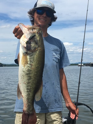
Tyler Morgan has lived in Columbus all his life and started fishing pot tournaments with his dad, Stan, when he was six years old. He fishes up to five tournaments a week on Bartletts Ferry/Harding and Eufaula now, competing in local pot tournaments and charity tournaments on both lakes.
A few years ago Tyler started fishing BFL tournament as a co-angler and won the Bulldog Division Co-Angler of the Year twice. Last year he changed to fishing the boater side and won the BFL at Lanier. He has fished 33 tournaments on that trail, winning four and finishing in the top ten 16 times.
Tyler impressed me with his ability to skip a swim jig into the thickest cover, places most fishermen never hit. He is like many younger fishermen, with skills and knowledge of fishing at 21 years old that far exceed my own, even though I am more than three times his age and have been fishing club tournaments more than twice as long as he has been alive. He is well equipped to further his fishing career.
“Bartletts Ferry/Harding is full of spots, some of them good size, but it has more quality largemouth than most fishermen realize,” Tyler said. He focuses on catching those big largemouth since they are what he needs to win tournaments, and his tackle selection and places he fishes reflects that goal.
For April, Tyler will have a square bill crankbait, a Z-Man Jackhammer Chatterbait, a Spro Popping Frog, a swim jig and a jig and pig rigged for fishing shallow pockets. He will throw a spinnerbait but finds he catches more fish on a swim jig than on a flashy bait. He likes to fish shallow year-round since he can catch big largemouth that way. He does catch some spots in the places he fishes and baits he uses, but they are not his goal.
We fished in early March, right after a cold front came through after two warm weeks the end of February, and dropped the water temperature several degrees, pushing the bigger fish back out. We caught a lot of bass but not the big ones hoped for.
1. N 32 41.588 – W 85 09.767 – Going up Halawaka Creek upstream of the Highway 379 “Long Bridge” past the small island on your right, there is a creek entering on the right at some condos. Go to the left bank across from the condos and start fishing the riprap in front of a brown house.
This creek is a good example of the kind of place Tyler fishes in April. He will fish fast, covering water looking for active bass. Start on the riprap with a square bill and parallel it. Sun on them warms the rocks and draws in bass to feed on baitfish and crawfish.
Tyler fishes a red crankbait since it imitates crawfish in April. He fishes it fast to see how active the fish are, but pauses it during the retrieve to stimulate a bite. He wants it bumping the rocks. If fishing it fast does not get a bite, especially early in the month, he will “count rocks” with his crankbait, slowing it down and bumping every rock with it.
Fish all the way around this small double creek. There are docks with brush piles, especially on the left bank going in, and Tyler with throw a jig and pig around the docks and brush. In more shallow area he will try a swim jig and chatterbait.
2. N 32 41.235 – W 85 09.993 – Going upstream and across the lake, where the creek narrows, a small cove is on your left. The upstream point is a grassy hill with a concrete seawall with posts in it and riprap at the base of it, going around the point.
Start on the outside of the point and fish around it with your crankbait. Also try a chatterbait, fishing it parallel to the rocks, too. Tyler likes a red and black chatterbait with a black Baby Brush
Hog trailer for the same reason he chooses a red crankbait.
When you get to docks, skitter a jig and pig under them. Also run a swim jig along the posts.
In the shallows, especially where there are grass patches, fish a swim jig through it. Also run it through any wood cover, from brush to blowdowns, in shallow water.
Fish all the way around this cove. Fish bed in the back and side ditches in it and the other places marked. Slow down some and look for beds in shallow water if it is clear enough to see them. If stained a swim jig over them will often make a big female show herself.
3. N 34 41.151 – W 85 10.388 – Go under the old railroad trestle and stop on the round point just upstream of the first pocket on your left. The point goes around to a bigger creek. Stop at the big concrete ramp and boat house pad and fish your crankbait and chatterbait parallel to the riprap around the point.
There is brush here on the rocks and that sometimes concentrates the fish. Fish it all, working both baits into the upstream creek. Use your jig and pig and swim jig around thicker brush and docks. Bass stage on the point both pre and post spawn and feed, then move back to spawn. Fish in the creek for the ones already in there, too.
4. N 32 41.256 – W 85 11.146 – Going up the creek the Prince Road bridge is to your left as the creek turns. On the right another smaller creek enters the bigger creek and is a good spawning area. It has a good bit of grass and a lot of wood cover in it so fish it all.
Stop on the point on your left going into the smaller creek, the one with a dock, boat ramp and light pole near the water. This flat point has a good bit of grass on it, so it is a good place for the swim jig as is the other grass and wood cover in this creek. You can spend a lot of time fishing here since the creek is fairly big and has several ditches and small arms in it.
Tyler uses a Dirty Jigs swim jig since it has a big, heavy hook needed when fighting a big bass on braid line in cover. He likes a white jig and puts a Zoom Fat Albert white twin tail trailer on it in stained water. If the water is clear, he will go to a more translucent jig and trailer.
Skitter the jig across the top of the water as far back into cover as you can. Be ready for a hit as soon as it stops. Start reeling immediately. Tyler twitches his rod tip constantly making the jig jerk and twitch on the retrieve. He says he loves the way bass slam a swim jig and inhale it.
5. N 32 40.772 – W 85 11.204 – Under Prince Bridge the creek goes to the right and a smaller creek enters on the left. Go into the creek on the left to the first point past the main creek point and start fishing. The point has a bleached out wood dock in front of a wood seawall. Fish from the dock around the flat pocket past it.
This shallow flat warms fast and has a lot of wood cover and some grass on it. Tyler says it holds a surprising number of fish, even though it does not look like much. A swim jig is good all around it since it comes through the grass without hanging and goes over wood cover even if it is on the surface.
If the bass don’t seem to want the faster moving swim jig, pitch a jig and pig to all the wood cover here. Let if fall by the dock posts and logs in the cove. Tyler uses a black and red or solid black three–eighths ounce jig with a matching Strike King Rage Craw on it.
6. N 32 40.605 – W 85 11.260 – Ahead of you a long flat point comes out and points to a steeper bank with a green shed, single and double boat docks on the opposite side. This is an old pond dam across the creek and it has rocks and some brush on it. It is a great staging area for pre and post spawn fish.
Fish across the dam, keeping your boat off it and running your crankbait over the top and bumping rocks with a jig and pig. You can also fish a Carolina rig or shaky head on it, but Tyler does not usually slow down enough to work those kinds of baits.
After fishing the dam work the steeper rocky bank on the other side, then fish around the back of the creek with swim jig and crankbait for fish back in there spawning. In April Tyler will always have a Texas rigged white Zoom Speed Craw ready to throw into beds when he sees them.
7. N 32 41.353 – W 85 10.260 – Going back down the lake under the railroad trestle the first fairly big cove on your left has a small dock in front of a brown brick house. The point has riprap around it and is a good feeding area for staging fish that spawn back in the cove.
Start on the riprap with crank bait and chatterbait. Go around the point into the cove, fishing wood cover and any grass with a swim jig. It is worth trying a frog on grass here and any other of these places if the water is 62 degrees or warmer. Tyler likes a black and yellow Spro Popping Frog but warns it is a big fish bait. You won’t get many bites, but those that do are likely to be big. Throw it for a kicker fish around grass, wood and docks.
8. N 32 40.991 – W 85 09.472 – Down the lake on your right a narrow point comes out and points downstream. It is on the upstream side of a narrow cove. On the left side going in, across from the point, is a rounded cement seawall that leads to a block boathouse on the bank with boat rails coming out of it.
Stop at the boathouse and fish the rails and seawall, then skip a swimming jig or frog under overhanging brushes along the bank. Not far down this bank is a small ditch where Tyler says he caught a five pounder off the bed last year.
Fish the back of the cove in the shallows with swimm jig while watching for beds. Pitch your Speed Craw to any you see and try to get the big female on them to hit. A frog over the beds and shallow wood will also get bites.
9. N 32 41.386 – W 85 09.182 – Down the lake behind the island on your left just above the bridge a small cove runs back a short distance. The left bank going in is steeper rock and concrete rubble and there is wood all along it. Start at the upstream point and fish around this cove.
The rocks and rubble offer a good feeding area for bass to eat crayfish so your crankbait and chatterbait are good. Tyler says a lot of bass bed back in the cove, more than you would think for such a small cove. Fish it carefully, working the dock and wood cover back here, and casting to places where beds should be even if you can’t see them.
10. N 32 40.940 – W 85 09.342 – Straight across the lake a small cove goes back from the lake and makes a short dogleg to the right in the back. It is just upstream of the big creek that enters closer to the bridge. There is green roof dock on the right bank and an underground house and shed in the back. Start at the green roof dock and fish around the cove.
Work the right and left sides with crankbait and chatterbait. The left bank has two concrete and rock piers and Tyler says bass often hold right on them. Work both sides carefully, and fish the very back in the shallows for bedding fish.
We caught small buck bass on almost every one of these places in early March. By now the females have joined them. Give them a try.
You can follow Tyler on Facebook and see some of his catches at https://www.facebook.com/tyler.morgan.980967
Do you find these Map of the Month articles helpful? If so visit http://fishing-about.com/keys-to-catching-georgia-bass-ebook-series/ – you can get an eBook or CD with an article for each month of the year on Clarks Hill and Lanier.