Alabama Concerned with Minimal Access to Rebounding Red Snapper Fishery
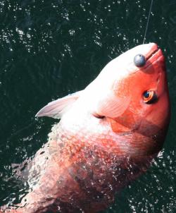
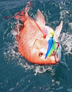
Red Snapper
Alabama Department of Conservation and Natural Resources
from The Fishing Wire
Despite an increase in the red snapper quotas for 2015, private recreational anglers will only see a one-day increase in the snapper season in the federal waters of the Gulf of Mexico.
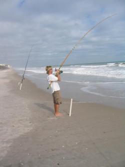
There are several factors involved in the setting of the private recreational season at 10 days. The private recreational red snapper season starts June 1 and ends at 12:01 a.m. on June 11.
First, the U.S. Department of Commerce recently approved the Gulf of Mexico Fishery Management Council vote for “sector separation” in the recreational fishery. The charter boat vessels with reef fish permits have been separated from the private recreational fishermen.
Another factor is the 20-percent buffer built into the recreational catch, which practically nullifies the increase in the recreational quota to 7.01 million pounds. The total allowable catch for both commercial and recreational sectors increased from 11 million pounds to 14.3 million pounds.
Probably the most contentious factor involved is the way the red snapper harvest is counted. The federal data collected through MRIP (Marine Recreational Information Program) indicated anglers caught 1.2 million pounds off the Alabama Gulf Coast. That’s almost two-and-a-half times the number of snapper compared to the Alabama Marine Resources Division’s Red Snapper Reporting Program’s estimate of 455,000 pounds of red snapper landed.
Chris Blankenship, Director of Marine Resources, said the sector separation allocated 42 percent of the recreational quota to the charter boat industry and 58 percent to private recreational anglers.
Under that allotment, the charter industry will be allowed 44 days of fishing from June 1 to 12:01 a.m. on July 15.
“We feel 10 days are totally unacceptable for the private recreational anglers,” Blankenship said.
“We are still working with Congress on changes to the Magnuson-Stevens Act that would give more control to the states,” he said. “Congressman (Bradley) Byrne is working on legislation that would give us more flexibility on the quotas, extend state waters out to 9 miles and assign the red snapper stock assessment to the Gulf States Marine Fisheries Commission instead of the National Marine Fisheries Service (NMFS). That legislation passed out of the Natural Resources Committee last week. So there is some movement in Washington on issues that would help us. Like I’ve said before, that’s what it’s going to take to get changes in red snapper management. The incremental changes through the National Marine Fisheries Service are not working.”
One action that could derail the current season dates is a lawsuit filed by the Coastal Conservation Association (CCA) in Louisiana that disputes the legality of the sector separation rules.
Blankenship said that may not be resolved until after the 2015 season unless the CCA can convince a judge to grant a temporary injunction against sector separation.
The one thing Alabama can do to offer a bit of relief to frustrated red snapper anglers is to open state waters to additional fishing.
Blankenship and Conservation Commissioner N. Gunter Guy Jr. have decided to open Alabama state waters to red snapper fishing from July 1 through July 31. Alabama enforcement officers will recognize a 9-mile boundary during the state snapper season, although federal enforcement officers may only recognize a 3-mile state boundary.
“I talked at length with Commissioner Guy, and we both feel like NMFS is being ultraconservative on a fishery that has rebuilt,” Blankenship said. “We don’t want to pack people into 10 days of fishing. It’s not fair with the good fishery we have out there.
“The 20-percent buffer that was put in last year for the 2014 season is part of the problem, and that has been continued for 2015. If we could add 20 percent back, it would add a couple of days to the season. It’s not much, but it’s better than nothing.”

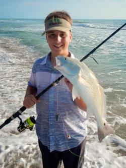
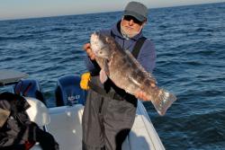
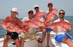
Good red snapper catch
Blankenship said the way NMFS calculated the 10-day private recreational season based on landings data from a revamped MRIP system.
“We just feel those landings were overinflated,” he said. “That’s what they used to determine the catch rate per day, and that is used to set the season length. If we can get regional control, we will be able to use our Snapper Check landings data to set the season and monitor the harvest. That should really benefit the people and give us a longer season.”
Alabama’s Red Snapper Reporting Program will again be mandatory for the 2015 season. The reporting system requires only one report per vessel trip, which can be filled out via smartphone app, online, by telephone, or by paper form. The toll-free telephone number is 1-844-REDSNAP (1-844-733-7627). Data collection drop-boxes have been erected at boat ramps at Boggy Point, Cotton Bayou and Fort Morgan in Baldwin County, Billy Goat Hole on Dauphin Island and Bayou La Batre in south Mobile County. And remember, regardless of where the red snapper are caught, a vessel landing report will be required if the fish are off-loaded in Alabama. Landing is defined as when seafood is transferred from a vessel to land or to a pier, dock, or bulkhead attached to land, or when a vessel is hauled onto land via a trailer.
“We need everybody to participate in the Snapper Check again this season so we will have two years of comparable data,” Blankenship said. “It’s going to take at least that before NMFS will make a change to the way they do data collection.”
While legislation winds its way through Washington, the Gulf Council will also discuss Amendment 39, which deals with regional management, at its meeting in Key West, Fla., in June. Under that plan, states would be allocated quotas according to historical landings. Alabama lands about 30 percent of the red snapper caught in the Gulf.
Blankenship said he understands the frustration expressed by recreational anglers like George Jordan of Daphne, Ala.
“We went (snapper fishing) one time last year,” Jordan said. “There’s only one weekend in the 10 days this year. People with businesses like us can only go on weekends. We may not even go this year. It’s just not worth it.”
Troy Frady, captain of the Distraction charter boat out of Orange Beach, Ala., said he hopes the system will be equitable to all segments of the fishing community, but he is glad to have a chance for a profitable season.
“I’m grateful to have something stable and have something for the American public to take home, that they’re able to have access to that natural resource,” Frady said. “It gives the charter boats an opportunity to make a living. It gives us something to catch while other species are closed during the summer months. Amberjack is closed in June and July. Triggerfish is closed for the entire year, so it’s more important to have snapper open to have access to fresh fish.”
Blankenship said every captain he has talked to in the charter industry seems to be happy with a 44-day season.
“I am glad for the charter industry,” Blankenship said. “That’s good for them and the economy of south Alabama, but I still think the charter boats would get more than 44 days to fish if we had state control of this fishery.”