How and Where to Catch September Lake Lanier Bass with GPS Coordinates

September 2013 Lanier Bass

 with Rob Jordan

    Tired of summer doldrums fishing for bass in deep water and not catching much? There is light at the end of September, when water starts cooling and bass get more shallow and active on our lakes. But why wait several more weeks?  You can catch some big spots at Lanier right now.

    Lanier is a big lake at 40,000 acres and since it is just northeast of Atlanta it gets heavy pleasure boat traffic, especially on weekends. And it gets a lot of fishing pressure.  The lake is known for its big spotted bass that took advantage of the introduction of blueback herring.  Five pound spots are caught often and most tournaments are won on spotted bass, with five-fish limits weighing 15 pounds common.

    Rob Jordan grew up fishing Lanier and now lives in Swanee.  His cousin Jim Murray, Jr. got him started tournament fishing and taught him a lot about catching bass.  Rob also worked with Jim painting custom lures and Rob has a business making realistic looking baits.  He also guides on Lanier and fishes tournaments.  Next year Rob plans on fishing the FLW Everstart and BASS Opens.

    This year Rob fished the Savannah River BFL trail and is right on the qualifying point to fish the Regional at Lanier with one tournament to go.  He hopes to do well in the Regional on his home lake.

    Rob’s best five spots in a tournament on Lanier weighed 21.5 pounds. This summer he has had big fish in two night tournaments.  Two years ago he placed third in the Weekend Series on Lanier and was in the top ten in the BFL there that year.  He knows the lake and how to catch good spots.

    “Lanier is a fantastic lake but you have to understand the waters and when the bass bite to do well,” Rob said.  It is a unique lake and you won’t catch the big spots by fishing like you do on other lakes.

    “The biggest spots are hard to catch since they roam the lake, living in water 50 to 60 feet deep,” Rob told me.  Weather and moon phases are keys to figuring out the bite. And you have to fish in the right places to catch the quality spotted bass.

    September is a transition month for spots on Lanier and you can catch some really big fish, especially late in the month.  Last year Rob got a six pound, six ounce spot toward the end of September on a guide trip.  But you can catch quality fish starting right now.

      A wide variety of baits will catch spots on Lanier this month. Rob will have a drop shot worm and a shaky head worm ready for slower fishing.  When the bite is good he likes a swim bait or a top water plug. All these baits are fished in deep water, with his boat often sitting in 80 plus feet of water and fishing water that is 30 feet deep.

    Rob will try a variety of depths and lures until he finds where the bass are feeding, and that depth will usually be consistent all over the lower lake.  The key is a long point or hump that drops off into very deep water. Standing timber in the deep water and brush or rocks on the humps and points make those places much better.

    Rob took me to the following ten spots in early August and we caught fish on most of them.  They are good right now and will get even better as the month progresses.

    1.  N 34 10.029 – W 84 02.492 – Green channel marker 3SC in Shoal Creek sits on a rocky hump right by the channel.  There is also a danger marker on it and one small bush stuck out of the water when we were there.  The hump is right off an island, too.  It always holds bass, according to Rob, and it typical of the type place he fishes this month.

    There is brush all over and around it as well as the natural rocks to hold feeding fish. Rob says it is important to locate the brush piles and fish them, so ride it with your electronics and mark the brush. Good electronics will even show the fish in the brush and how they are setting up on it.

    Start on the upstream end and work the whole area, keeping your boat out in the channel.  Wind rippling the surface of the water is critical here and on other spots to make the fish active, and overcast days help, too.

    If there is some wind and some clouds try a big swim bait like the Bucca Bull Herring hard swim bait or a Zman Grass KickerZ over the brush. Topwater plugs like a big Spook or Sammy will draw the bass up to the top from the brush.

    If the water is slick or it is sunny Rob will fish a Zman StreakZ on a drop shot or a Big Bass Baits jig head with a worm on it in the brush.  It is important to get the baits right on the fish so work each brush pile carefully, especially if you see fish in or around it.

    2.  N 34 11.681 – W 83 03.607 – Run over to Young Deer Creek and right in the mouth of it on the left side going upstream marker 1YD sits on a hump with a danger marker and some bushes on top.  Again, it is right on the channel where deep water is very close to shallow water. 

    Your boat should be in about 100 feet of water and you want to fish brush around 30 feet deep. Rob says 30 foot deep water is usually a good depth in September but they may feed a little shallower later in the month. If you are not catching fish in the deeper brush, or if you see them in more shallow brush, try it.

    Rob says bass are caught here every day. There are a lot of brush piles and big rocks on the hump to cover.  Try all your baits around them.

    A big swim bait is Rob’s go-to bait if he wants quality fish. In a tournament where five bites from big fish is all you want, try the Bull Herring worked slowly over the brush.  Rob’s custom painted versions are best since the spots on Lanier see so many swim baits but all will catch bass.

    3.  N 34 11.766 – W 84 03.499 – Across the mouth of Young Deer Creek channel marker 2YD sits on a deep rocky point that is excellent.  Rob fishes the downstream end of the point where it runs out parallel to the channel.  You will be sitting in 70 to 100 feet of water when fishing the end of the point.

    First try the swimbaits and topwater. Always keep a topwater plug ready to cast immediately to surfacing fish.  We caught a couple the day we fished when they came up near us. They may not stay up long so be ready.  If the spots are consistently schooling on top but not staying long, Rob will stand in the front of the boat with a topwater bait ready to cast, waiting on them to come up again.

    4.  N 34 12.494 – W 84 01.432 – An island sits in the mouth of Six Mile Creek and marker 4SM sits just off it. The creek channel is on one side and the river channel on the other.  Rob says this is one of the best big spot holes on the lake and he caught a six pounder here. 

    There are stumps and brush piles on the point on the downstream side of the island where the big spots live. Rob says a big swim bait or topwater is the way to go here for the big ones.  Work both baits all around the point, concentrating on brush piles and stump beds you find with your electronics.

    Rob fishes both hard and soft swimbaits with a steady retrieve and keeps them near the surface is there is cloud cover or wind on the water.  When a fish hits he sets the hook with a sweep of his rod, not a hard set, and does not drop the rod tip. 

    If there is little wind or if the spots just don’t seem to eat the big bait, Rob will drop down to the smaller size Zman SwimmerZ soft swim bait.  He fishes the soft baits on a three sixteenths to three quarter ounce jig head depending on how the fish set up. The lighter head is better for running the bait shallow but the bigger head will allow you to fish it a little faster and deeper.

    5.  N 34 13.464 – W 84 01.406 – Further up Six Mile Creek it narrows way down right at channel marker 7SM.  There are several good humps and points in this area. The left side going upstream, between the last cove on that side to the point where the creek narrows way down, have the better ones.

    The danger marker on the left sits between two long points that are excellent. Sit out in 45 feet of water and cast up into 25 to 30 feet of water.  There are a couple of road beds, an old house foundation and brush piles on the points.  Fish them all.

    The pinch point where the creek narrows way down funnels fish into this area as they move up the creek in the fall. Rob says when the water temperature drops into the 70s it is like a switch turns on and the bass get into action chasing bait. Swim baits and topwater are even better when it cools down.

    6.  N 34 14.772 – W 83 56.843 – Run up the river to the mouth of Flat Creek. A big island sits in the mouth of it and red channel marker 26 is on a point where the river channel swings in toward it. Rob says bass live here year round and it is always good, but in September even more bass get on the point while moving into the creek.

  Sit out in 40 feet of water and cast up on the point with all your baits, starting shallow and working deeper. There are rocks and brush piles here that hold the fish. If you can’t find the brush with your electronics, drag a jig head worm along the bottom until you hit rocks or brush and work it.                 

    7.  N 34 13.602 – W 83 55.772 – For a change of pace run into Mud Creek all the way to the narrow creek channel in the back.  Rob fishes docks back in places like this. Spots and some big largemouth can be found back around docks in creeks as the water cools.  Fish all the docks from the ones on the left past the big rocky point where it narrows down all the way around the creek.

    Try a one eighth to three sixteenths ounce jig head with a Zman finesse worm on it.  Fish all of each dock, from the deepest water in front of it to the back under the walkway.  The bass may be feeding anywhere around the docks. 

    The bass will be on the outside deeper docks early in the month but move further back as the water cools. Since the weather this summer has been fairly cool and the rain and cool weather in the middle of August kept the water temperatures down, they may move further back sooner this year.

    8.  N 34 13.967 – W 83 56.271 – Going out of Mud Creek Old Federal day use park with a boat ramp is on your left.  Past it a long point runs out toward the main lake and there is an island off the bank, with danger markers between it and the main point. 

    Stop about even with the island in Mud Creek and idle over the ridge that runs out on that side toward the Mud Creek channel.  This ridge runs way out and has rock and brush on it, and bass stack up on it all summer long. Even more move to it as they follow shad back into the creek in the fall.

    Sit in about 40 feet of water and cast up on top of the ridge to 20 to 30 feet of water.  Try all your baits.  When using a drop shot in the brush Rob likes to pitch it ahead of the boat a little rather than fishing it straight under the boat. He will let the lead hit bottom, raise his rod tip to keep the bait up off the bottom and twitch it in one place, moving the lead very slowly as he works it around the brush.

    9.  N 34 13.447 – W 83 57.774 – Out off the end of the point with Old Federal Campground there is a big flat point with a danger marker off a small island with bushes on top.  There are brush piles all over it but Rob’s favorite area of this big point is downstream of the island and danger marker. 

    As in other places, start with topwater and swim baits over the brush piles you locate with your electronics, then try the dropshot and shaky head.  Rob likes a light one sidxteenths to one eight head, as light as conditions will allow, since the slow fall will often draw a strike.

    Rob lets the shaky head hit bottom then slowly drags it along with an occasional snap of the rod tip to make it wiggle and jump. Many people shake it in one place, as the name implies, but Rob moves it slowly along the bottom without constant shaking.

         10.  N 34 11.424 – W 83 58.442 – In Flowery Branch across from the Van Pugh ramp a long underwater point runs off the upstream side of the danger marker between the small island and the main point.  This point actually runs off Van Pugh park out to the island then on out toward the creek channel.

         Stay out on the creek end of the point and work it with all your baits.  Resident fish live here and more move in during the fall.  If you are fishing a tournament use big baits for a few quality bites. Use smaller topwater baits like the Sammy 100 early in the fall but go bigger later. For numbers the shaky head or drop shot will get more bites.

         All these places hold bass right now and will get better as the month progresses and the water gets cooler. Give them a try and you can find many more just like them.

         For a guide trip with Rod to see first hand how he fishes Lanier call him at 770-873-7135 and check his web site at http://robjordanfishing.com  Also check out his custom painted baits at http://www.xtremelurecreations.com

Mako Shark Tracking


Mako Shark Tracking Reveals “Impressive” Memory and Navigation
from The Fishing Wire

These top predators travel far across the Pacific, returning to the same areas in the Southern California Bight each year. The largest effort ever to tag and track shortfin mako sharks off the West Coast has found that they can travel nearly 12,000 miles in a year. The sharks range far offshore, but regularly return to productive waters off Southern California, an important feeding and nursery area for the species.

The findings demonstrate “an impressive show of memory and navigation.” The sharks maneuver through thousands of miles of the Pacific but return to where they have found food in years past, said Heidi Dewar, a research fisheries biologist at NOAA Fisheries’ Southwest Fisheries Science Center in La Jolla, California.Researchers tagged 105 mako sharks over 12 years—from 2002 to 2014. The tags record the sharks’ movements, as well as the environments the sharks pass through.

Researchers have long recognized that ocean waters from Santa Barbara south to San Diego, known as the Southern California Bight, are an important habitat for mako sharks. Prior to this study, however, they knew little about what the sharks do and where they went beyond those waters.The researchers are from NOAA Fisheries, Stanford University, Tagging of Pacific Predators, and the Center for Scientific Research and Higher Education in Baja California. They reported their results in the journal Animal Biotelemetry.

“We did not know what their overall range was. Were there patterns that they followed?” asked Nicole Nasby-Lucas, a NOAA Fisheries research scientist at the Southwest Fisheries Science Center and lead author of the new research. “It turns out they have their own unique movement patterns.

” Sharks tracked over multiple years returned to the same offshore neighborhoods year after year.

Long-Range Travelers The tagging data overall revealed that the sharks travel widely along the West Coast. They venture as far north as Washington, as far south as Baja California, and westward across the Pacific as far as Hawaii. The sharks tagged off California remained on the eastern side of the Pacific east of Hawaii. This indicates that they do not mix much with mako sharks in other parts of the Pacific.

A roughly seven-foot female mako shark followed similar courses into the Pacific and back to the California Coast over three consecutive years.

Although there are examples of mako sharks crossing the ocean, it is probably the exception rather than the rule, said Dewar, a coauthor of the new research.The finding provides insight into population dynamics of mako sharks across the Pacific. It also allows scientists to identify which fisheries the tagged mako sharks might encounter. Muscular mako sharks are a popular sport fishing target. They are also caught in U.S. longline and drift gillnet fisheries and are common in the international trade in shark fins.

Mako sharks are overfished in the Atlantic Ocean, but not in the Pacific.The researchers used two types of tags to track the sharks. One type, called pop-up tags, collect data and eventually pop off the animal and float to the surface, where they transmit their data via satellite. The second type transmits data to satellites each time the shark surfaces, determining the animal’s location by measuring tiny shifts in the frequency of the radio transmission.

Remembering Southern California Mako sharks are among the fastest swimmers in the ocean, hitting top speeds of more than 40 miles per hour. The larger tagged sharks traveled an average of about 20 miles a day and a maximum of about 90 miles per day. They travel long distances in part because they must swim to move water through their gills so they can breathe, Dewar said.

Large numbers of juvenile sharks caught in the Southern California Bight indicate that it is a nursery area for the species. Tagged mako sharks returned there annually, most typically in summer when the waters are most productive. The tracks of the tagged sharks may look at first like random zig-zags across the ocean, Dewar said. They actually illustrate the sharks searching for food and mates based on what they remember from previous years.

“If you have some memory of where food should be, it makes sense to go back there,” Dewar said. “The more we look at the data, the more we find that there is a pattern behind their movements.”The tagging results also provide a wealth of data that scientists can continue to plumb for details of the sharks’ biology and behavior. About 90 percent of the time the sharks remained in the top 160 feet of ocean, for example, occasionally diving as deep as 2,300 feet. Although the sharks traveled widely, they mainly stayed in areas with sea surface temperatures between about 60 and 70 degrees Fahrenheit.

“We can continue to ask new questions of the data to understand these unique movement patterns,” Nasby-Lucas said. “There’s a lot more to learn.”
Juvenile shortfin mako shark swimming in the waters off California. Photo credit: Walter Heim.

Fishing Lake Chickamauga

Chickamauga Bass with Jeremy York

Chickamauga has been the best bass lake in the Southeast, if not in the whole country, the past few months.  Many eight pound plus bass have been landed and in most tournaments you didn’t even need to weigh in if you had five bass weighing less than 25 pounds.

The bad news is the patterns producing those incredible stringers working the first three months this year are over. The good news is those bass are still there, hungry in May and can be caught on a variety of new patterns. 

Chickamauga is a TVA Lake just outside Chattanooga on the Tennessee River.  It runs 59 miles from the dam up to the Watts Barr Dam, with many big feeder creeks.  Although it is not in Georgia or Alabama, many fishermen in our state are less than three hours away and make the trip often. If you are not one of them you are missing out on some incredible bass fishing.

Jeremy York owns Angler’s Warehouse near Athens, Georgia.  Two years ago one of his pro staff invited him to sample the great bass fishing that was just being discovered on Chickamauga. He went up and caught some big bass and fell in love with the lake. He now makes the three hour drive several times a week in the winter and does some guiding on the lake, about 25 trips so far this year.

Jeremy is a tournament fisherman and fishes the pro trails as well as local and regional tournaments. In the BFL on Chickamauga in March he weighed in five bass weighing 30.25 pounds – and came in third!  In another tournament he had five weighing 27 pounds and came in 14 place.

In five guide trips in March he and his clients had their five best weighing 26, 39, 36, 30 and 32 pounds.  That is better than a six pound average for four of the five trips.

In five trips this year he and his clients have landed an eight pound plus fish in each.  One of his best trips was with a father and son. Within a few minutes of starting the father landed an 8.75 pound largemouth, he landed a 6.5 pounder and then the son landed an 8.68 pound fish, all within the first hour. 

Jeremy found a pattern that works great from the beginning of January through March.  When the water temperature hits 48 degrees the bass really turn on and 48 to 52 is the ideal water temperature.  It starts slowly as soon as the water reaches 45 degrees. The pattern holds until the water gets to about 58 degrees, usually around the first of April, and the bass head toward the bedding areas.

Although this pattern is over this year, it is worth remembering for next year.  Jeremy came up with the idea for the Extreme Bait Ball Rig that is sold by Picasso. It is an Alabama rig with teasers on the arms, so it looks even more like a school of baitfish. That is what he caught the big bass on from January through March.

He rigs it with one eighth ounce Buckeye Jewell heads on the hook arms and rigs them and the teaser attachments with either a 3.5 or 4.5 inch Shadalicious blue gizzard or Texas shad swimbaits. For bigger bass he runs the 4.5 inch bait on the hooks with smaller ones on the teasers, or runs the bigger size on all. 

The ideal rig for throwing this heavy bait is an I Rod Bama Rig Special Genesis II rod with a Revo SX reel spooled with 80 pound Power Pro braid. He tried several reels and all wore out in a few trips except the Revo. 

There are three things to remember when throwing this rig.  Lob it, don’t make a usual cast.  Keep reeling when you feel something until the bass almost jerks the rod out of your hand. You will hit stumps with it and if you set the hook you are unlikely to get the rig back. And finally, when you do hang up, keep your line tight as you go to it, go past the hangup and pop it loose with small pops of the rod tip.

Jeremy took me to Chickamauga the second week of April and warned me the great bite was probably over. Although he got a nice 4.5 pounder first thing that morning on the rig, fishing was slow. We went into the spawning pockets and they were full of bass just starting to fan beds. The fish were very spooky and we could not get them to hit, but we saw many in the six pound plus size starting to bed.

Adding to our problems that day the water rose almost two feet while we were there.  The lake is scheduled to be at full pool by April 15th each year and it was four feet low when we got there.  But it was filling fast.

When the water temperature is right Jeremy fishes transition areas like stump flats near the mouths of spawning areas.  There needs to be deep water nearby with a shelf or flat with stumps on it. A ditch or cut running across the flat is key. The bass feed on those types of places during the winter and pre spawn.

Other good types of cover are banks where big rocks transition to chunk rock to sand, often found at the mouths of feeder creeks and coves. Big largemouth and smallmouth both like this kind of area and will hit the rig fished there.  On one trip this year he got a six pound smallmouth and a six pound largemouth.

On the stump flats keep your boat out in deeper water near the cut or ditch and cast up to four or five feet of water. Work your rig back steadily, keeping it above the stumps but near the bottom. On the transition banks stay out a long cast from the bank and cast near it, fishing the rig back to cover water two to six feet deep.

File this information away for next year. But now for the good news. Those big bass are still in the lake and you can catch them right now. Fishing will be good from now through May and you can use a variety of baits to catch them.

Right now about half the bass, especially the bigger fish, are on the beds or have been in the last few days. You can sight fish for them or drag a Carolina rigged lizard through the bedding areas. If sight fishing, look for stumps, the favorite place for a bass to bed on Chickamauga.

Jeremy likes a Big Bite Baits Fighting Frog on a light Texas rig, a white swim bait with a weighed keel hook or a whacky rigged Senko rigged weightless for sight fishing.  He will cast well past the bed and pull the bait to it, letting it drop into the sweet spot.  Let it sit and shake it and the bass will usually eat it if they are hard on the bed.

Good areas for sight fishing are in Soddy Creek, which usually has the clearest water on the lake, and other creeks on the lower half of the lake.  The pockets up the river are full of spawning bass, too, but they are harder to see since the water is usually more stained there.

Another good area is Dallas Bay around Chester Frost Park. Jeremy says there have probably been 100 eight pound plus bass released there in tournaments this year and they will not leave the bay since the spawn is approaching. They will stay in the bay, feed until spawning and then gradually work back out to the river, feeding on post spawn areas.

The stump flats on both sides of the ramp are good spawning areas to check since they are littered with stumps.  Be careful, the flats run way out. Try to follow the ditches and cuts going back into them since the bass will follow them. Often the biggest bass will be bedding on stumps closest to the deeper water in the cuts.

Bass move into the spawning areas in waves and about half of them are there now the last week of April.  More will move in during the next few weeks, depending on water temperature and moon phase.  They will stay on the bed for about a week then move off and spend about a week recovering. They won’t feed much during that week but will start feeding heavily after that so there will be a lot of hungry fish all during the month of May.

To catch post spawn fish Jeremy will try a variety of baits. A Spook or similar walking bait worked over the stump flats will draw explosive strikes. Keep your boat in the cuts and cast ahead of you down the cut and fan cast the flats on both sides.  Cover a lot of water, fishing fast until you find feeding fish.

A swim jig worked over the same areas will also catch fish, especially if the fish are not real aggressive. Swim it in the same places you worked your topwater.  You can also work a spinnebait over those areas or try to bump the stumps with a square bill crankbait.

Toward the end of May there will still be a few bedding bass but the bream spawn comes into play. Bass will feed on the bream that are bedding in the same areas as the bass use, so fish a swim jig around the bedding bream to catch those bass feeding on bream.

Another big key in May is the shad spawn.  Chickamauga has two kinds of shad, both threadfin and gizzard shad, and golden shiners, all favorite foods of bass.  The shad will spawn on gravel and shell bed flats and rocky banks this month and the bass often go wild feeding on them. Jeremy says the shell beds on flats near the river channel are a huge key to the shad spawn so seek them out.

Look for the schools of shad running the banks early in the morning or working the flats.  Jeremy likes to see smaller areas of shad spawning. If there are shad spawning on 100 yards of bank there might be 20 bass feeding on them and they will be real scattered out. If there are shad on only about 20 feet of bank, those same 20 bass will be concentrated and easier to catch.

A spinnerbait, rattle bait or swim jig all work well on the shad spawn. Work them over the flats, running them right on the bottom.  On the banks, cast right to the bank, even up on the rocks and pulling your bait into the water.  The bass will be facing the bank so you want to cast as shallow as possible.

The shad usually spawn early, the first couple of hours of light on sunny days, but will stay shallow much longer on cloudy days.  If it is sunny and the shallow activity stops, back off and fish a little deeper to catch the bass following the shad out a little ways off the bank where they hold until the next morning.

Why is Chickamauga so hot with big bass right now? Jeremy says the stocking of Florida and Northern strain largemouth as produced a cross, an F1 hybrid that grows very fast and is very aggressive.  Tennessee DNR reports show they stocked both Florida and Northern strain largemouth as well as F1 hybrids in 2002.  Those fish have reached trophy size and their offspring are reaching bragging size every year.

Jeremy thinks the next two years are going to be fantastic, with some huge bass caught in Chickamauga each year. All those eight to ten pound bass will mostly still be around for a couple of years and could be two to three pounds heavier. And all those five and six pounders will also be two to three pounds heavier.

For the future, there are a lot of four and five pound bass coming along, too. There is a 15 inch size limit on largemouth and an 18 inch size limit on smallmouth on Chickamauga and those limits have contributed to the larger fish in the lake.  That size restriction also insures a good supply of quality fish for the future. So the fishing should stay really good for the foreseeable future. You definitely want to head to Chickamauga and get in on catching them.

A three day non resident Tennessee fishing license is $16 and can be bought on line before your trip.  A ten day license is $25 and an annual license, good until February 28, 2014, is $80.  You might want an annual license since you are sure to fall in love with fishing Chickamauga.

West Coast Rockfish Boom


West Coast Rockfish Boom with Warm Water “Blob”
Young groundfish, including great numbers of rockfish as well as other marine creatures thrived under unprecedented ocean conditions, according to new research.

The high temperatures that came with the marine heatwave known as the Blob led to unprecedented mixing of local and subtropical species. There were, often with new and unpredictable outcomes. Out of that mix came one unexpected winner: West Coast rockfish. These bottom-dwelling species, which that had previously collapsed in the face of overfishing during the 2000s, thrived under the new conditions.

Scientists from Oregon State University and NOAA Fisheries’ Northwest Fisheries Science Center recount the boom in young rockfish in a new research paper in the journal Fisheries. It examines the effects of the Blob as documented by NOAA Fisheries offshore surveys. Scientists have been conducting the surveys for more than 20 years. The Blob years brought some of the most dramatic changes in marine life off the West Coast they’ve ever seen. Unexpected interactions may have also altered the abundance of some species, from plankton that support the food web to fish that depend on them, the researchers wrote.

In the waning months of the Blob in 2016, juvenile rockfish increased over a large area from California to Alaska. Since juvenile rockfish are very difficult to distinguish from one another, scientists could not tell which species benefited. They could not tell what specifically drove the boom in their numbers and or whether they will support fisheries in future years.

They suggested that the surge in rockfish may have been part of an unusual cascade of effects resulting in large part from a shift in the dominant jellyfish off the West Coast. The typically abundant sea nettle declined in number while the less common water jellyfish multiplied to become the most abundant jellyfish in their catches. That may have reduced predation by sea nettles on juvenile rockfish, as well as competition between the species.A catch of mostly water jellies and only a few fish from a 2015 research survey off the West Coast.

“When organisms from different regions suddenly come together, they can interact in unexpected ways,” said Brian Beckman, a research fish biologist at the Northwest Fisheries Science Center and co-author of the new study. “The question is whether this is a lasting change, or one that will shift back toward something we’ve seen before.

”The scientists also described the sudden and extremely high abundance of gelatinous pyrosomes. They, which had never been previously observed in the Northern California Current off the West Coast. Pyrosomes have such voracious appetites that their increase may explain low concentrations of chlorophyll documented off the West Coast in 2017, the scientists suggested.

Pyrosomes found off the Oregon Coast range in size from a few inches to more than two feet long. (Photo by Hilarie Sorensen/University of Oregon)“If this organism remains abundant in subsequent years, it could produce lasting effects upon the ecosystem by outcompeting other filter feeders, which in turn might reduce the food supply to organisms higher in the food web,” they wrote.

The effects of the Blob may be evident in the species mix off the West Coast for many years to come, they added. The scientists emphasized that continued ocean surveys should track those changes over time. This will to help us understand the interaction among species and inform ecosystem-based fisheries management.Read more like this at NOAA Fisheries
Shortraker rockfish.

Lots of Fishing

The last month has been a whirlwind of fishing for me.  Five club tournaments, one of them a two-club tournament, and trips to Chatuge and Guntersville for magazine articles have put me in boats in all kinds of weather during that time, with mixed results.     

On November 24 ten members of the Spalding County Sportsman Club fished our November tournament at Bartletts Ferry.  After eight hours of casting, we brought in 31 keeper bass weighing 40.11 pounds.  There were three five fish limits and no one zeroed.     

I won with five weighing 10.74 pounds and had big fish with a 3.09 pound largemouth.  Billy Roberts was second with five weighing 7.10 pounds, Jay Gerson placed third with five at 5.72 pounds and Wayne Teal came in fourth with four weighing 4.30.   

I went with a low goal of catching one keeper for points since that would just about guarantee I would win the points standings for the year. I got a keeper largemouth at 9:30 And relaxed. At 1:30, with 90 minutes left to fish, I was easing down a bluff bank across from the weigh-in, just waiting.    Another fisherman pulled in ahead of me about 100 yards away and started fishing toward me.  He made many casts to a small point as I fished toward him, then he fished toward me, fishing two of the three docks between me and him.  After he fished the next one from the one I was fishing, he left.   

I started to leave but decided to keep fishing. I moved to the dock he had just fished, cast a shaky head to it and landed a short bass. The next cast to that dock produced the big fish of the tournament.    On the point he had just fished I landed four more keepers in the next hour, culling the little one I had caught that morning.

I love it when that happens, somebody pulls in front of me and I catch fish behind them. I don’t like it so much if someone fishing behind me catches fish I left, but I am careful to never pull in front of anyone fishing, no matter how badly I want to fish a place!   

The next weekend the Sportsman Club and Flint River club finished out our year with a two-club tournament at Jackson.  We had 12 fishermen and after eight hours we brought 33 keepers weighing about 37 pounds. There was one five bass limit and no one zeroed.   

Raymond English won with five spots weighing 5.37 pounds, I came in second with three at 4.78 pounds and Glen Anderson was a close third with four weighing 4.75 pounds.  Wayne Teal placed fourth with two weighing 3.59 pounds and his 2.72 pound largemouth was big fish.   

We started in sprinkling rain, wind and clouds but the wind blew the clouds away at about 10:00 AM.  I got three bites while it was cloudy and landed my three keepers, surprisingly two of them largemouth. That was it, no matter what I tried the rest of the day I never hooked another fish.   

Potato Creek is at Jackson today. I hope the weather and fish cooperate!  (they kinda did – i won!) 

Last Monday I drove the 170 miles to Lake Guntersville to meet Mike Carter to get information for my January Alabama Outdoor News Map of the Month article.  We met at noon and it was 37 degrees, windy and cloudy.  And while we were on the water, there was a light snow shower!   

Mike showed me a pattern in the river he had shown to a tournament fisherman in October that helped him and his roommate win first and second place out of almost 200 boats.  He also showed me a pattern that produced a nine pounder for him last year and an 11 pounder for a client a few years before that.   

Even under the awful conditions, Mike caught a nice fat three pounder so I could get a video and pictures for the magazine! We were on the water only three hours, too long under those miserable conditions.   

The week before, on November 25, I went to Lake Chatuge to meet Barron Adams to get information for my January Georgia Outdoor News Map of the Month article.  Barron showed me why he is such a successful tournament fisherman, catching about ten fat spotted bass on a cold day.   

I managed to hook four spots weighing two to three pounds while Barron landed ten that size. He caught his on an underspin and an A-Rig while I caught mine on a spoon, either cast out and hopped off the bottom back to the boat or dropped and jigged off the bottom straight under the boat.   

The two lakes are very different.  Although both have mountains near them, at Chatuge they are right on the lake.  Chatuge is deep and clear, with rocky shorelines and little cover. Guntersville is shallow and flat, with miles of grassbeds, stump fields and channels to fish.   

There are some spots as well as smallmouth in Guntersville, but Chatuge has almost all spotted bass, with some big largemouth, but nothing like the size of the ones at Guntersville.   

Fishing will be cold for the next two to three months, but bass fishing can be very good, especially for big bass.  I caught my first two eight-pound bass back in the 1970s during January club tournaments at Jackson, and my biggest ever, a 9-pound, 7 ounce largemouth, that I caught in an early February tournament at Jackson.   

Those big fish were caught before spotted bass took over Jackson. Now you are much more likely to catch ten or 15 11-inch spots than one four pound largemouth.  And it has been years since I saw anyone catch a bass weighing over six pounds there.    Don’t stay home just because its cold outside!

Winter Feeding Area for Great White Sharks


OCEARCH Defines Winter Feeding Area for Great White Sharks
Tracking data from white sharks equipped with OCEARCH satellite tags reveals that the Atlantic continental shelf waters off North Carolina, South Carolina, Georgia, and the east coast of Florida are a winter hot spot for large white sharks. As seen on the OCEARCH Tracker, the heavy concentration of our adult and near-adult white sharks in this region suggests it’s an important winter habitat, which OCEARCH and collaborating scientists are now referring to as the Northwest Atlantic Shared Foraging Area (NASFA).

This is in concordance with fisheries data that showed this area to be a wintering ground for white sharks, as previously published by OCEARCH collaborator Dr. Tobey Curtis and his colleagues.The OCEARCH Tracker shows at least eight white sharks have been detected in the NASFA in the past week, including adult white sharks Hilton and Katharine. The eight sharks are a good indication there are plenty more white sharks in the area with them.

The waters off Charleston, South Carolina and Cape Canaveral, Florida have seen the highest concentration of detections. The sharks were tagged as part of an ongoing study started in 2012 by OCEARCH to uncover the mysteries of white sharks’ life history in the Northwest Atlantic.

Since the beginning of the study, OCEARCH has consistently observed that nearly all tagged, large white sharks in the Northwest Atlantic visit the NASFA at some point during their migrations, with most visiting in the winter. OCEARCH has tagged white sharks as far south as Florida and as far north as Nova Scotia, Canada, and all of the larger tagged sharks have spent some time in the NASFA.

“The body of colder water trapped between the Gulf Stream and the coast is a key feature of this region,” says Assistant Professor of Marine Science at Jacksonville University and OCEARCH collaborating scientist Dr. Bryan Franks. “This ‘wedge’ of cold water extends from the Outer Banks in North Carolina down to Cape Canaveral in Florida. This feature results in a range of water temperatures in a relatively short horizontal distance from the coast out to the Gulf Stream. In addition, there is the potential for abundant prey in the migrating populations along the coastlines and in the dynamic mixing zone on the Stream edge.

”The tendency for white sharks to migrate to the NASFA bears some similarities to white shark behavior observed in the Pacific Ocean off the west coast of the United States. In the Northeast Pacific, different shark populations migrate from the Farallon Islands and Guadalupe Island to a Shared Foraging Area (SOFA), also popularly referred to as the White Shark Cafe, between the Baja Peninsula and Hawaii.

OCEARCH tracked this white shark behavior in 2007-2009 and conducted a 30-day expedition to the SOFA in 2009. Studies by other scientists since then have tracked similar shark behavior.

OCEARCH tracking data in the Atlantic suggest there could be more than one population, or subpopulation, of white sharks inhabiting the Northwest Atlantic. These populations are differentiated by where the sharks aggregate in the late summer and fall, which is suspected to be mating season for the species, although that remains to be confirmed. Cape Cod, Massachusetts is one such summer/fall aggregation site and OCEARCH data indicates there is at least one more summer/fall aggregation site in Canada. Regardless of which summer/fall aggregation site a shark uses, however, it appears nearly all of the adult and near-adult sharks visit the NASFA during the colder winter months.

OCEARCH is planning an expedition to the NASFA in February and has two other expeditions planned to try and tag more sharks off Massachusetts and Nova Scotia later in 2019. These expeditions aim to increase the sample size of tagged white sharks to get a clearer picture of white shark movements in the Northwest Atlantic and test scientific hypotheses about white shark movement and migration.

“This is the beauty of OCEARCH’s North Atlantic White Shark Study,” said Dr. Bob Hueter, OCEARCH Chief Science Advisor. “The sharks lead us from one step to the next, so that we can steer our ship to where we’re needed to fill in the gaps in our knowledge of this incredible predator. Each expedition builds on the previous ones to reveal the life of the white shark from birth to death in the North Atlantic. This is the best kind of science, and it’s exciting to be sharing these discoveries with our peers and the public.

”Follow the sharks through their migration cycles by accessing the near-real-time OCEARCH Tracker; https://www.ocearch.org/white-sharks-gather-in-northwest-atlantic-shared-foraging-area-off-southeast-coast-of-the-us/

Where and How to Catch February Bass at Sinclair , with GPS Coordinates

February Bass at Sinclair 

with Todd Goade

NOTE – THIS WAS WRITTEN BEFORE THE POWER PLANT WAS CLOSED AND TORN DOWN.

Cold winter weather always puts a damper on bass fishing in February on most of our lakes.  Bass go deep and school up tight and don’t eat much. But Lake Sinclair is an exception to that rule.  The warmer waters from the steam plant make it the most popular lake for club and other tournaments this month.

There is a good reason so many tournaments are held on Sinclair in the winter. Bass are more active because the water is warmer and also because of the currents created by the steam plant intake and outflow as well as those generated by power generation and pump back at the Oconee dam.

Sinclair is a 15,330 acre Georgia Power lake on the Oconee River.  It was dammed in 1953 and the lake is ringed with cabins and docks.  Almost all docks are on posts and many have brush piles around them.  There is a lot of grass in the lake and it still attracts baitfish this time of year although it is brown now.  There are sandy pockets and banks, rocks and wood cover to fish. 

When Plant Harlee Branch, the coal fired steam plant, is taking in water to cool its boilers, current near the mouth of Little River around the bridge and intake moves upstream.  In Beaverdam Creek release of warmer water from the boilers not only heats the lake, it creates a strong current around the discharge, under the bridge and downstream.

When the power plant at the Oconee Dam is generating current a strong flow comes down the river.  When the turbines are reversed and water is being pumped back into Oconee there is a strong current going up the river.  This current also affects the creeks and will reverse the flow in Little River, too.  The strongest effects are from the mouth of Little River upstream.

Most of Lake Sinclair stays stained in February with Little River often the muddiest area.  Near the dam, Island and Rock Creek almost always remain clear.  Those creeks down the lake are also less affected by the warm water so are usually the coldest water on the lake.  So you can fish shallow relatively warm stained water or colder clearer water within a few miles.

Sinclair is usually one of the top three lakes in Georgia for numbers of tournaments reported in the Georgia Bass Chapter Federation Creek Census Report, with over 80 tournaments reported each year.  In recent years Sinclair has been one of the best lakes for numbers of bass with over 20 percent of anglers catching a five fish limit.  But the bass are small, with an average weight of about 1.5 pounds and an average tournament winning weight of about 10 pounds.

 Todd Goade remembers the first bass he ever caught and it turned him on to bass fishing. He was eight years old and caught a six pound bass on a topwater plug in Missouri. That would turn on any fisherman, especially a young fisherman.

Most of his life Todd lived in Tennessee where he fished with local clubs and the pot trails. When he moved to Georgia in 2002 he quit fishing for a few years but got back into it in 2005 and started fishing the BFL trail, the HD Marine Trail, Boating Atlanta and others. 

Over the past few years Todd has been very consistent in tournaments, placing in the money in many of them.  Last year he finished 3rd overall in the Bulldog BFL point standings and in 2006 was 7th in the HD Marine point standings.  Last February he finished in the top 20 at Sinclair in the BFL and needed just one kicker fish to finish much higher.

“There are always some shallow fish at Sinclair,” Todd told me.  He prefers to fish Sinclair shallow this time of year and likes to go after them with lighter tackle and smaller baits than most anglers use.  Finesse fishing will catch lots of bass on Sinclair most winter days and will often get you in the money in tournaments.

For fishing Sinclair this month Todd has a variety of baits rigged and ready. He will have a small jerkbait like a Pointer on a spinning rod with eight pound test line, a Texas rigged Zoom Finesse worm and another Finesse worm on a 3/16 Spot Remover jig head, both on eight pound line, a crankbait like a Bomber 7A or a Bandit Flat Maxx and a small spinnerbait on 10 to 12 pound line and a Carolina rigged Zoom Baby Brush Hog or six inch lizard. He will also keep a Flexit Spoon ready for deep jigging if he spots bass holding on deep structure.

Todd prefers to fish in eight feet of water or less and will often be sitting in 12 to 15 feet of water fan casting a point or working a bank.  Although the bass are shallow they will usually be on cover and structure with deep water nearby.  He likes main lake banks and points or banks near creek channels that drop off fast now.

Current will position bass on structure and sun will position them on cover, according to Todd.  He likes banks and points where the current is moving and will concentrate on brush, docks and rocks when the sun is bright. This time of year Todd says he does better on sunny days.

Todd and I fished Sinclair the second Sunday in January, a tough day for us and others, based on the weigh-in of three clubs at Little River that day.  He showed me the following places he likes to catch fish on Sinclair in February and they will hold fish you can catch, too.

1. N 33 11.211 – W 83 17.476 – The bank above the steam plant intake drops off fast has overhanging brush and rocks along parts of it and the pockets have grass in them.  Todd likes to fish along this bank and often catches a limit of keeper size bass here.

Start on the point above the mouth of the intake on the right and work upstream to the next main lake point.  The channel swings in near the big upstream point and the deep water is good. You will be sitting in 12 to 14 feet of water along most of this bank.  The water is usually stained in this area and is warmed by current coming up the river.  When water is being pulled into the steam plant current will run downstream.

Cast a Texas rigged Zoom Finesse worm under the overhanging brush to the rocks and also work it around any grass you see.  Todd likes a green pumpkin worm and will dye its tail chartreuse.  Work it with short hops and jiggles, trying to hit any cover along this bank.

If water is moving and the bass are more active, cast your jerkbait close to the bank and work it back in short jerks. Try several cadences until the bass show you what they like.  The colder the water the slower you should fish the bait with longer pauses between jerks.

2. N 33 11.351 – W 83 16.242 – Run down the lake past the mouth of the river and watch for the first cove on your left. There is a big mesh satellite dish on the point.  Go into the pocket downstream of this dish and start fishing before you get to the first dock that has a green metal roof and several PVC rod holders on it.

Fish down this bank with your Texas rigged and jig head worms, casting to the bank between docks and working under the docks and around the posts.  When you get to the third dock you will know you are in the right spot if you see a big UGA emblem on the dock and house and the walk going up from the dock has little UGA helmet lights and a sign that says “Dog Walk.”

Fish that dock and the grass just past it. You can run a spinner bait through the grass and work your worm rigs around it, too.  Todd likes a small white spinner bait with silver blades.  He fishes this cove to the dock with the US flag on it and stops since the water gets real shallow past it.

3. N 33 11.330 – W 83 15.679 – Across the river is an island and just downstream of it a marked hump. There are three danger buoys on the hump and three PVC poles, two side by side. Stop straight out from the PVC poles in about 25 feet of water and fan cast your crankbait as you ease in toward the poles. You can cast to the top of the hump and it is very rough here.  Try a worm along the bottom, too.

If you have a GPS on your boat you will see a point running out from this hump and that is where you want to stop and start fishing.  You can see the point on a good map, too.  The contour lines will be close together and that is a key Todd looks for this time of year. That shows a fast dropping bottom and the fish hold on those kinds of places.

4. N 33 09.806 – W 83 13.802 – Head down the lake to the big island just upstream of the mouth of Reedy Creek and the airport.  There is an old quarry under the water on the upstream side of the island and the bottom is hard clay.  Stop on the outside point of the island in about 20 feet of water and work around the point, casting a crankbait up shallow. Try to hit the bottom with it.

After working the crankbait back off a little and cast a Carolina rig or other worm rig here. There is a good brush pile in 12 to 14 feet of water that often holds bass. They will hold in the brush and run in to feed.  Probe the brush carefully with all your worm rigs.

5. N 33 09.752 – W 83 13.973 – Idle over to the center of the upstream side of the island. You will see three points, the one you just left and two more. Stop out from the center point and you will be in the quarry in very deep water.  Fish the center point here with your crankbait, then probe for brush in 16 feet of water.

Todd likes a half-ounce lead on his Carolina rig and usually has a 24 inch leader.  He will drag the green pumpkin lizard or Brush Hog with dyed tails around and through the brush, working it slowly and feeling for any resistance. The bass will be sluggish most days in the cold water.

6. N 33 11.106 – W 83 12.509 – Run toward the back of Island Creek and watch for a bright red barn on the left side before you get to the power lines.  Start on the point just upstream of the pocket with the red barn and work around the shallow pocket to the dock with a green slide on it. The bottom drops off fast and it is rocky, with docks and brush along it.

Fish your Texas rigged worm or jig head worm here, hitting rocks and wood cover on the bottom and also fishing around and under all the docks. Todd says this is a good place to find bass pulled up to feed this time of year.  He will hit this place and others several times during a fishing day since fish may move in to feed anytime during the day.  You just have to be there when they are feeding.

7. N 33 10.775 – W 83 12.444 – Running down the middle of Island Creek back toward the river, watch on your left for a flat point with a seawall around it. There is a house sitting way back from the water but nothing out on the point.  Across the creek you will see a big brown brick house and just upstream of it a green roof dock.

On a line between the point and green roof dock, out in the middle of the creek, is a hump that comes up to about 18 feet on top. There is brush on it.  Todd will stop here and jig a spoon on this hump, especially if he sees baitfish or fish near the bottom with his depth finder.  It is close to the creek channel and often holds a school of fish. He says he will not spend a lot of time here but does check it out.

8. N 33 09.568 – W 83 12.765 – Near the mouth of the creek on your left is a small island sitting close to the bank.  A long shallow point runs off it toward the middle of the creek.  Todd stops his boat just upstream of the island, lining up the trees on the upstream side of it with the red top dock on the bank behind the island.

Sitting in 15 feet of water he will cast a crankbait all over this point, covering it with fan casts.  He will also try his jerkbait here as well as worm rigs.  This long underwater point is typical of the kinds of places winter bass hold on Sinclair and the water is clear enough here they will come up for a jerkbait.

9. N 33 09.448 – W 83 12.700 – Downstream of the island a big cove runs from the island to the main lake point between Island Creek and the river.  About in the middle of this cove is a long shallow point running out to deep water.  It has a sharp drop off on the downstream side.

Look for and old high boat house roof with no sides and a gazebo on the bank near it. There are swift gourds on a pole near it.  Just downstream is a gray roof dock with a boat ramp just upstream of it.  The point runs out with the downstream sharp edge right at the ramp. You can see this point on your GPS or map, too.

Todd starts way out on this point and make long fan cast across it with crankbaits and jerkbaits.  Try to hit the drop from several angles. Then work your worm rigs across the point and down the drop for fish that are not very active.

10. N 33 08.296 – W 83 11.535 – Run down to the dam and start into Rocky Creek. On your right is a point between the river and the creek.  There is a Georgia Power park and pavilion on the bank here.  This point runs way out shallow and Todd starts way off the bank with his boat in 15 to 16 feet of water and casts his crankbaits up toward the point. You will be casting to water about eight feet deep.

Try to bump the bottom with your crankbaits. Todd likes a fire tiger coach dog pattern for his Bomber and will usually throw a pearl and chartreuse or blue back Flat Maxx. Those baits will dive deep enough to bump bottom in eight feet of water so you will cover the depth many bass will feed this time of year.

Check out Todd’s spots and try his methods on Sinclair this month. There are many other similar spots you can then find and fish.  You should catch a lot of keeper size bass.

Non-Navigable Waters Rule


New Mexico Fish and Game Acts on Non-Navigable Waters Rule
The New Mexico Fish and Game Commission (NMFGC) has voted to amend or repeal an agency rule allowing landowners to certify non-navigable waters as private property, subjecting anglers wading these waterways to a trespass statute.

Days before the vote, the state Attorney General’s office (AG) issued its opinion that the commission can’t legally block the public from waterways that cross private property, as long as people don’t trespass across that property to reach the waterways. In 2015 (by a one vote margin) state legislators amended a trespass law, essentially barring the public from wading in streams that run through private property without written permission from the landowner. 

Three months later the NMFGC called an “emergency meeting” to allow a hearing on the rule, which limited public comment to 10 days, rather than the 30 days set by the Legislature. In 2017 the Commission began allowing landowners to certify streambeds as “non-navigable,” and to fence, and declare the streambed as private property.

Five certification applications have been issued by the Commission since adoption of the rule. One certification was issued to the Texas owner of the Rio Dulce Ranch in San Miguel County, privatizing a segment of the upper Pecos River. Another certification was issued to Chama Troutstalkers, owned by Dan Perry, and ended public access to a segment of that northern New Mexico river. Perry owns a ranch and outfitting business that offers fishing trips there for about $500 a day. 

An organization he founded, the Habitat Conservation Initiative, spearheaded the effort to pass the 2015 change to state law.Zane Kiehne is also seeking certification for his Texas-based Z&T Cattle Company on the Mimbres River in the southwestern part of the state. Kiehne also gained certifications for waterways running through separate properties on the Alamosa and Penasco rivers. The bill’s supporters contend allowing public access to streams on private property could disturb riparian habitat improvements that landowners had invested in. Opponents say the law, and commission rule, are vague and unconstitutional, and that courts should decide whether streambeds are public.

The New Mexico Wildlife Federation, Backcountry Hunters and Anglers, New Mexico Avid Anglers, Dona Ana County Associated Sportsmen, Southwest Consolidated Sportsmen, Wild Turkey Sportsmen’s Association, River Reach Foundation, Adobe Whitewater Club, American Canoe Association, American Whitewater and the New Mexico River Outfitters Association are all seeking to overturn the law and game agency rule.

The “non-navigable” clause maintains that as long as a river or creek is considered navigable under New Mexico state law the public can float and access it, but the NMFGC’s rule has effectively removed that right on non-navigable waters.

Three Attorneys General have concurred that a 1945 New Mexico Supreme Court decision in “State Game Commission vs. Red River Cattle Co.” allows the public to utilize streams and streambeds where they run through private property, providing they don’t trespass onto private land from the stream.

Jesse Deubel, executive director of the New Mexico Wildlife Federation, said, “New Mexico anglers and sportsmen who rely on our public lands need a fair shake from the game department.” Attorney Marco Gonzales, who represents the landowners who had certified stretches of waterways, told the commission to let the issue be resolved by the Legislature and the courts.

Last July, when the Commission issued a 90-day moratorium on the certifications, Perry told “The Santa Fe New Mexican” trespassers had damaged the area he had posted and killed many fish.“It’s really hard on the environment,” Perry said. “And it’s our private property, too.”

“New Mexican families and landowners deserve access to our waterways,” said AG Hector Balderas. “I will be directing the commission to strengthen the process to protect private property rights and minimize trespass, while respecting access rights and outdoor activities of sports enthusiasts.” Gonzales said at a public heating recently, “This is an important constitutional issue about ownership of private property. New Mexico’s waters are public waters — you are able to float and fish, you just can’t wade, because of the streambed.” NMFGC Chairwoman Joanna Prukop said, “We were told by the state attorney that the rule was invalid, and our offices are subject to liability for enforcing it. We directed the department yesterday to enforce criminal trespass as they would on any other water in the state until we have resolved this rule.

”While the Commission did not set a timeline to produce a new plan, it could act on the directive at its January meeting in Las Cruces.—Etta Pettijohn

Ten Holes To Catch February Bass on Lake Guntersville, with GPS Coordinates and Tips

February Bass at Guntersville 

with Randall Tharp

Say the word “Guntersville” and bass fishermen all over the US perk up their ears. The lake has an almost mystical reputation for big stringers of bass, especially in late winter.  This reputation has been built up over the years by the great catches there in tournaments and most of the national trails visit the lake each year.

From its dam near Guntersville in northeast Alabama the lake extends 76 miles up the Tennessee River into Tennessee. It is Alabama’s largest reservoir with waters covering 67,900 acres and 890 shoreline miles.  It stays very stable since the TVA requires a set depth in its channels. Water will seldom vary more than two feet in depth which is good since vast areas of the lake are very shallow flats.   

Built between 1936 and 1939, Guntersville has seen a lot of changes the bass population.  The lake is very fertile and full of hydrilla and milfoil but one of the main reasons the bass are so big now is the size limit.  On October 1, 1993 a 15-inch size limit was placed on bass.  That size limit now includes smallmouth and largemouth and it allows smaller, faster growing bass to reach quality size. 

According to the Alabama DCNR there are growing numbers of bass bigger than 15 inches in the lake each year and they are in good shape.  The numbers of bass 12 to 24 inches long has consistently increased each year since the size limit went into effect. In the BAIT survey Guntersville has the highest weight per bass and the shortest time to catch a bass over five pounds of all lakes reported.

All this does not mean Guntersville is a piece of cake when it comes to catching keeper bass.  The BAIT survey shows Guntersville ranking pretty far down the list in percent of angler success, number of bass per angler day and pounds of bass per angler day. If you don’t know the lake every acre of it looks like it holds bass and you can spend a lot of time with nothing but casting practice.

Randall Tharp knows the lake well.  Although he has been fishing all his life he got started tournament fishing with a club about seven years ago and really liked it.  He started fishing Guntersville in 2002 and now has a place on the lake.  He has learned its secrets and has had great success there. 

In 2007 Randall placed first in the point standings in both the Bama and Choo Choo Divisions of the BFL.  He came in third in the Bama BFL on Guntersville last February then placed first in that division in September and second there in the Choo Choo Division the same month.

The past few years reads like a dream come true in Randall’s resume on Guntersville.  In 2006 he placed second in the Bassmasters Series Crimison Divison in March and eighth in that series Volunteer Division the same month, won the seventh Annual Kickin’ Bass Coaches tournament there in June, got a fifth in the Bassmasters Series Crimsion Divison in September, and second in the Choo Choo BFL in September.

He also won the 2005 BITE Tournament on Guntersville in April and was second in the BITE Championship there in November.   Guntersville has played an important part in Randall’s tournament winnings and has helped him get Ranger Boats and Chattanooga Fish-N-Fun as sponsors.  He is planning on fishing the Stren Series and some other bigger trails like the BASS Opens if he can get in this year.

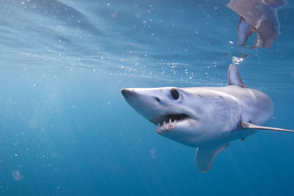
Randall gets excited when thinking about fishing Guntersville this time of year because he knows what lives in the lake.  He says from now to March is the best time of year to hook a monster bass here and expects to catch some of the biggest fish of the year. When asked what it would take to reach “monster” status he said a 10 pound bass would qualify and he expects to catch one that big.  He has seen bass in the low teens caught this time of year, too.

There are lots of ways to catch Guntersville bass from the end of January to March but Randall usually sticks with shallow water. He says the colder it gets the more shallow the big bass hold, and he seldom fishes deeper than 10 feet. You will be surprised at the numbers of big bass in less than three feet of water on the coldest days when the water is in the 30s, according to Randy.

Right now Randall will have a Rapala DT 6 or DT 10, a Cordell Spot or Rattletrap, a one quarter to three eights  ounce jig and pig to cast, a Texas rigged Paca Craw with a heavy weight to flip in any thick grass he finds and Pointer jerkbait read to try.  He likes shad colors in the crankbait and the red in the lipless baits.  Worms and craws are usually green pumpkin and he also casts a black and blue jig and pig.

Although the grass is not growing much right now there is still some “stubble” on the bottom that will hold bass. Randall looks for flats near a drop and it helps to have grass on the bottom.  He finds those kinds of places back in the creeks and out on the main lake but winter winds often make it impossible to fish open water.  He likes to have some protected areas as well as open water to fish.

Bass don’t have to move much on Guntersville, according to Randall. They live in the same areas year-round, not migrating long distances like they do on some lakes. They will follow baitfish some but the grass provides so many bluegill on Guntersville that Randy thinks they are the major food source for bass.

Bass are predictable this time of year and Randall finds them in similar places each year.  They move some but will usually be near a creek channel or ledge where there are good shallow water flats with grass stubble.  They may concentrate in one area then move a little but they won’t move from the main lake to the back of a creek in a day or so.  That helps when practicing for a tournament, but it also means many fishermen find the same fish.

No matter which bait you use it is important to fish as slowly as possible in the cold water.  When your crankbait gets stuck in grass pop it loose gently and let it float up. Do the same with a Spot or Trap, popping it a little and letting it flutter back down. The bass don’t seem to want to chase a bait far, especially if it is moving fast, but Randall says they still hit hard. This time of year, even with the water in the 30s, will provide bone-jarring strikes and it feels like the bass will rip the rod out of your hand.

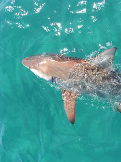
Randall and I fished on Guntersville in December and the bass were real scattered in the remaining hydrilla although the beds were getting sparse.  Randy still landed about 20 bass that day and had two over five pounds. He could have weighed in five between 19 and 20 pounds, an excellent catch on most lakes but Randall was disappointed the big ones did not hit!

Check out the following ten spots.  They run from near the dam to far up the river.  Bass will hold on all of them this winter and there are other similar spots all over the lake. You just have to fish and find where the concentrations are to load the boat with big fish.

1. N 34 35.939 – W 86 33.106 – The long causeway crossing Brown’s Creek and the shallow humps downstream of it is one of the best places to catch a big bass this time of year.  He says if he had to pick one place to land a ten pound bass he would never leave Brown’s Creek.  Randy landed his best bass from Guntersville, 10 pound, 11 ounce hawg, from this area on a jerkbait.  You can find areas on the riprap that is also more protected from the wind than the main lake.

Work around the riprap, especially the downstream side, with a jerkbait and both kinds of crankbaits.  Also cast your a jig and pig on the rocks.  Some days the fish will be near the rocks and others they will be holding a little deeper, the rocks in some places run out 18 to 20 feet deep.  You can see on a good map there are points and drops near the riprap and hydrilla grows on the more shallow spots.

Downstream of the causeway but near it there are humps that rise to three or four feet deep and hydrilla forms mats on them in the summer. There will still be enough grass near the bottom to hold bass now.  You may have to fish around the area while watching your depthfinder to locate these shallow spots.

Throw a Spot or Trap across them and follow up with a crankbait. Fish them very slowly.  Once you locate some fish you can slow down and fish a jig and pig across these shallow areas.  You should feel the grass on the bottom and that will help you locate the best spots. These humps are exposed to the wind.

2. N 34 40.711 – W 86 20.501 – Run up to the mouth of Town Creek and stop at the ramp on your right going in. Start fishing that bank working a lipless crankbait over the hydrilla that remains in the area.  There is deep water near the point at the ramp and bass move up and down this bank feeding.

When you reach the back of the creek where Minky Creek splits to the left jump across and fish that creek, working it as you go in. You will see three big brick houses here and there are milfoil beds to fish. This creek is shallow and holds good fish this time of year.

Fish it all the way back in Minky Creek. Remember Randy says big bass are often in three feet of water or less this time of year and may be way back in the creek.  Fish Traps and Spots and crankbaits.  If you don’t get bites on them try a slower moving jig and pig or jerk bait.

3. N 34 42.026 – W 86 25.223 – Across the lake follow the channel markers going into Siebold Creek and stop when you get to the island on your left not far off the bank.  Start fishing the islands from there to your left toward the back of that arm.  There are humps, points and islands to fish along this side.

Fish are in this area now getting ready to stage for bedding. You can often catch several on a Trap or Spot from an area then work it with a black Enticer one-quarter ounce jig with a blue or black Zoom Chunk.  Cast and fish it in the grass stubble on the bottom. Work it as slowly as possible.

Randall says fish the Trap and Spot right on the bottom, crawling it along and getting it stuck in the grass. Then pop it gently loose and let it fall back to trigger a strike.  You will get many more hits if you fish it with an irregular action than if you just chunk and wind.

4. N 34 45.843 – W 86 19.364 – The bank downstream of Little Mountain Park has humps, grass and duck blinds.  Randy says get on this bank, put your trolling motor down and fish, there are always lots of big bass holding in this area.  Some of the humps come up to only a foot deep and there are cuts and holes that are nine to 10 feet deep.  

The shallows near those holes are usually the hot spots.  Some ditches cross the flat, making deeper holes. There is a grassline where the water drops deeper along here and the edge of the grass is the key.  Fish a crankbait along the drop when you can.  There is milfoil here and the breakline is always good.

You can work this whole area from the point at Meltonsville to the marina at Little Mountain.  Fish over the grass with Trap and Spot but be sure to cast a jig to the duck blinds, too. Just make sure no hunters are present!  By now that should not be a problem.

5. N 34 50.405 – W 86 17.087 – Pine Island is a huge grass island in the middle of the river out from Waterfront Grocery Fishing Tackle and Supplies.  This is Randall’s favorite spot on the river year round. The river channel splits and goes on both sides of the grass and drops off 35 feet deep but the top of the island is only three or four feet deep.  There is also a cut in the middle of the island that is more than 12 feet deep.

This area is so vast it is hard to fish. You can spend many hours here fishing what seem to be excellent grass lines and drops without catching anything, then hit a spot that is loaded with quality bass.  For some reason they will school up in one small spot that seems to us to be just like the rest.

Fish a Trap, Spot and crankbait along the breaklines and over the grass until you find the sweet spot. Once you locate a good school of fish they should hold there for a good while.  The head of the island creates a current break and the shallows near deep water make excellent structure for bass.

6. N 34 30.943 – W 86 09.017 – Run up to channel marker 372.2, a big marker on a pole.  The South Sauty Creek channel runs into the river channel just upstream of this marker and the channel edges and grass lines along it are good this time of year. Work all your baits along both creek channels looking for concentrations of bass.  Cuts and points on the old channels are good holding spots for the fish.

 If you start near the channel marker and fish upstream you can follow the river channel. The break for the creek channel is not far from the channel and if you look almost straight up the river but a little to your right you will see the creek channel markers.  It doe not run out straight from the creek but swings out then runs down parallel to the river for a long way.

Randall says you can start at the channel marker and fish up into the creek or stay on the river. You can fish the river ledge and grass stubble along it for seven miles going upstream and find schools of bass all along here. That gives you a good idea of the amount of water you have to cover to find schools of fish at times.

While fishing this spot and others Randall says to watch for any action on the water. Often a bass will chase a baitfish making it flick on top of the water giving away the position of a school of bass. It is always worth your time to go to any activity you see and fish around the area.

7. N 34 61.747 – W 86 11.057 – Run back into North Sauty Creek past the second bridge. Fish above the bridge around the lily pad stems, stumps and milfoil with lipless crankbaits and a light jig and pig.

This creek offers three causeways to fish and is more protected than the open river.  Randall says you can start at the second bridge and work the creek edges all the way past the first bridge and out to the river channel. The first bridge has some riprap to fish.  Also fish the bridge and riprap at Goose Pond on the side creek coming in.

The creek channel that winds across the flat downstream of Goose Pond Marina out to the main river channel is a good place to work carefully. There are a lot of tournaments at the marina and lots of fish are released there, restocking the area constantly.  The concentration of keeper size bass is good here from those that are released. Randy says lipless crankbaits, shallow running crankbaits and a light jig and pig will catch them here.

8. N 34 60.472 – W 86.00.655 – Run up the river to the power lines. Both the outside channel ledge and the inside channel ledge from here to BB Comer Bridge have good grass stubble on them and holds a lot of fish.  This time of year Randy likes to fish the back side of the ledge so work in behind the grass, too.

Keep your boat in 10 feet of water and cast out toward the river channel. You will be covering the ledge in about five or six feet of water.  Work Traps and Spots as well as a lipped crankbait across this area. As in other places, watch for any change like a cut or rise and slow down when you catch a fish.

9. N 34 64.971 – W 86 00.000 – Go into the mouth of Rosebury creek back to the ramp on your left.  Start fishing the bank across from the ramp working toward the back of the creek.  Keep your boat near the creek channel and cast to the edges, working your bait over them.  Fish all the way to the causeway in the back of the creek. There are stumps and milfoil to fish here.

This creek is where Randall has his camper and was his first stop in one of the BFL tournaments. He limited out here then went looking for bigger bass to cull. He often finds good numbers of bass back in this creek this time of year.

10. N 34 76.768 – W 85 90.325 – Go up to Mud Creek and in past the boat ramp. When the channel markers stop be careful but keep going to the second bridge and under it.  The big area where the creek splits into Owen Branch and Blue Springs Branch often holds big bass this time of year. Back in this area are huge stumps near the creek channel and you don’t want to hit them with your motor, but they are what attracts the bass.  There is also lots of shallow milfoil in this area. 

Keep your boat in the channel and follow it, casting to both sides to hit stumps and other cover along the drop.  You will be in about six feet of water and casting to very shallow water but Randall says this is where he found fish holding for several weeks   when the water was 36 degrees and his rods were freezing up.

These places show you the kinds of cover and structure Randall looks for this time of year. You can fish them to get an idea of what to look for then find some similar spots of your own. These are big areas but the fish can be anywhere in them so take some time to find where they are holding. Once you get on them it will help you find them in other spots.

Shark Facts


12 Shark Facts That May Surprise You
From NOAA Fisheries
from The Fishing Wire

1. Sharks do not have bones. Sharks use their gills to filter oxygen from the water. They are a special type of fish known “elasmobranch”, which translates into fish made of catilaginous tissues—the clear gristly stuff that your ears and nose tip are made of. This category also includes rays, sawfish, and skates. Their cartilaginous skeletons are much lighter than true bone and their large livers are full of low-density oils, both helping them to be buoyant. Even though sharks don’t have bones, they still can fossilize. As most sharks age, they deposit calcium salts in their skeletal cartilage to strengthen it. The dried jaws of a shark appear and feel heavy and solid; much like bone. These same minerals allow most shark skeletal systems to fossilize quite nicely. The teeth have enamel so they show up in the fossil record too.Scalloped hammerhead shark.

2. Most sharks have good eyesight. Most sharks can see well in dark lighted areas, have fantastic night vision, and can see colors. The back of sharks’ eyeballs have a reflective layer of tissue called a tapetum. This helps sharks see extremely well with little light.A night shark’s green eye.3. Sharks have special electroreceptor organs.Sharks have small black spots near the nose, eyes, and mouth. These spots are the ampullae of Lorenzini – special electroreceptor organs that allow the shark to sense electromagnetic fields and temperature shifts in the ocean.4. Shark skin feels similar to sandpaper.Shark skin feels exactly like sandpaper because it is made up of tiny teeth-like structures called placoid scales, also known as dermal denticles. These scales point towards the tail and help reduce friction from surrounding water when the shark swims.Sandbar shark skin.

5. Sharks can go into a trance.  When you flip a shark upside down they go into a trance like state called tonic immobility. This is the reason why you often see sawfish flipped over when our scientists are working on them in the water.Tagging smalltooth sawfish Florida Everglades6. Sharks have been around a very long time.Based on fossil scales found in Australia and the United States, scientists hypothesize sharks first appeared in the ocean around 455 million years ago.Grey reef shark.

7. Scientists age sharks by counting the rings on their vertebrae. Vertebrae contain concentric pairs of opaque and translucent bands. Band pairs are counted like rings on a tree and then scientists assign an age to the shark based on the count. Thus, if the vertebrae has 10 band pairs, it is assumed to be 10 years old. Recent studies, however, have shown that this assumption is not always correct. Researchers must therefore study each species and size class to determine how often the band pairs are deposited because the deposition rate may change over time. Determining the actual rate that the bands are deposited is called “validation”.

8. Blue sharks are really blue. The blue shark displays a brilliant blue color on the upper portion of its body and is normally snowy white beneath. The mako and porbeagle sharks also exhibit a blue coloration, but it is not nearly as brilliant as that of a blue shark. In life, most sharks are brown, olive, or grayish.Blue shark.

9. Each whale shark’s spot pattern is unique as a fingerprint.  Whale sharks are the biggest fish in the ocean. They can grow to 12.2 meters and weigh as much as 40 tons by some estimates! Basking sharks are the world’s second largest fish, growing as long as 32 feet and weighing more than five tons.Whale shark.

10. Some species of sharks have a spiracle that allows them to pull water into their respiratory system while at rest. Most sharks have to keep swimming to pump water over their gills.A shark’s spiracle is located just behind the eyes which supplies oxygen directly to the shark’s eyes and brain. Bottom dwelling sharks, like angel sharks and nurse sharks, use this extra respiratory organ to breathe while at rest on the seafloor. It is also used for respiration when the shark’s mouth is used for eating.Nurse shark.

11. Not all sharks have the same teeth. Mako sharks have very pointed teeth, while white sharks have triangular, serrated teeth. Each leave a unique, tell-tale mark on their prey. A sandbar shark will have around 35,000 teeth over the course of its lifetime! Shortfin mako shark.12. Different shark species reproduce in different ways. Sharks exhibit a great diversity in their reproductive modes. There are oviparous (egg-laying) species and viviparous (live-bearing) species. Oviparous species lay eggs that develop and hatch outside the mother’s body with no parental care after the eggs are laid.

Shortfin mako shark.