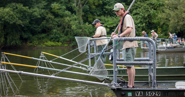
 DWR biologists electrofishing while sampling fish populations on a water body. Photos by Meghan Marchetti/DWR DWR biologists electrofishing while sampling fish populations on a water body. Photos by Meghan Marchetti/DWRBy Alex McCrickard, DWR Aquatic Education Coordinator from The Fishing Wire Have you watched some of the videos from aquatic biologists at the Department of Wildlife Resources (DWR) and seen a boat outfitted with long, wand-like poles with dangling cables? Have you ever showed up to a river or stream and witnessed a crew of biologists with large backpacks and long rods extending into the water? This unusual-looking activity is called electrofishing, and it’s modern science in action. 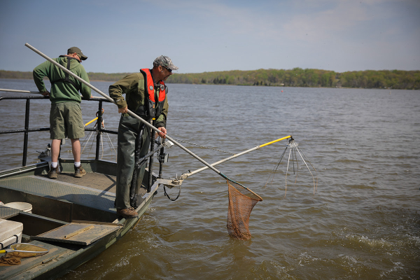 Electrofishing in action.As Virginia’s state fish and wildlife agency, DWR is responsible for the management of our fish and wildlife resources for the benefit of the public. Our agency staff work hard to conserve and protect our freshwater fisheries across the Commonwealth. The best way to monitor the health of fish populations is to catch a number of fish from one area at one time. While our aquatics biologists are all excellent anglers, there is a more efficient, safe, and effective way to catch the fish! Electrofishing in action.As Virginia’s state fish and wildlife agency, DWR is responsible for the management of our fish and wildlife resources for the benefit of the public. Our agency staff work hard to conserve and protect our freshwater fisheries across the Commonwealth. The best way to monitor the health of fish populations is to catch a number of fish from one area at one time. While our aquatics biologists are all excellent anglers, there is a more efficient, safe, and effective way to catch the fish!Electrofishing is a common method used in fisheries science; this type of biomonitoring is truly one of the most effective ways to monitor our fisheries. Fish can really help tell the story of the health of a certain waterbody. They are in the water 24/7 and are constantly exposed to the elements. Some species are more tolerant to pollution than others. The make-up and diversity of a water body’s fish population can help tell the story of water quality and inform our agency’s biologists. In turn, all of this influences sound management decisions that can improve habitat, water quality, and fish health, which benefits the general public and anglers who cherish Virginia’s freshwater resources. So, you now might be wondering what exactly happens during electrofishing? What’s going on behind the scenes during these surveys? Our electrofishing FAQs below cover these basics. What is electrofishing? Electrofishing is a technique used in fisheries science to sample fish populations. Sampling is when biologists study a number of fish from a certain area, measuring and examining them and recording the statistics. When biologists electrofish, a generator or battery gives off an electrical current that runs through the water. Volts, amps, and frequency can be adjusted based on water temperature, conductivity, and other variables. Electrofishing can take place on foot with a backpack unit on a small stream or river. For larger rivers and lakes, electrofishing typically takes place from a boat or barge. From a boat, the anodes enter the water from a long boom off the bow. Electrical current travels from anode cables back to the cathode(s)–in many cases, the metal hull of the boat acts as the cathode. The electrical field typically expands 5 to 7 feet in circumference from each anode and down about 6 to 7 feet. The size of the electrical field can vary depending on conductivity, voltage, and frequency of electrical current. Fish are temporarily stunned as the electrical current causes their muscles to contract. The fish then float towards the surface where they can be easily netted. Is electrofishing harmful to fish? Electrofishing has the potential to be harmful if not used properly; however, biologists have the training and experience to operate the equipment safely and effectively while minimizing impacts to fish. Prior to any sampling, biologists adjust and monitor electrofishing settings to the target species in a particular habit. In some cases, electroshocking is avoided during spawning periods and habitats of certain rare and endangered species to eliminate even the perception of harm. Does electrofishing affect different species of fish differently? Yes, the frequency of the electromagnetic current can affect species differently. For example, low frequency electrofishing tends to only affect catfish species. When we sample tidal rivers to assess the catfish populations, we solely use low frequency. High frequency sampling is often used for standard community assessment of multiple species. Because of their larger surface area, big fish such as bass and muskie are more susceptible to electroshocking than small fish such as minnows and darters. Electrofishing is only efficient in shallow water, so sampling is usually conducted when all species and sizes of interest are likely to be vulnerable to this technique. Why do DWR biologists electrofish? What’s the goal for sampling and what do DWR biologists do with the fish during electrofishing? Electrofishing is an effective method to assess the health of a fishery in a non-lethal manner. It allows biologists to evaluate the health, variety, size distribution, and abundance of fish species on a given body of water and how that population can change over time. Length and weight measurements further allow biologists to assess overall fishery health. This type of sampling allows DWR to look at interactions within a fish population. Furthermore, we can track status of endangered and threatened species or the status of spread of any invasive species. All of this information influences sound management decisions that benefit the public who recreate on these resources.DWR staff weigh, measure, and evaluate the fish netted during electrofishing, keeping careful records of the information. The information collection during electrofishing helps DWR fisheries biologists make sound management decisions for fish populations. Is electrofishing safe for the DWR biologists? Yes, because of their training and experience, DWR biologists are safe when electrofishing. Our biologists wear non-breathable waders that keep them from being shocked while using backpack electrofishing units. For electrofishing boats, numerous electric cut-offs are in place to prevent accidents, and the boat is grounded. All DWR biologists wear personal flotation devices while sampling on boats. DWR biologists have also had formal training in electrofishing principles and techniques (for example the U.S. Fish and Wildlife Service electrofishing course), which contributes to the safe operation of electrofishing gear. 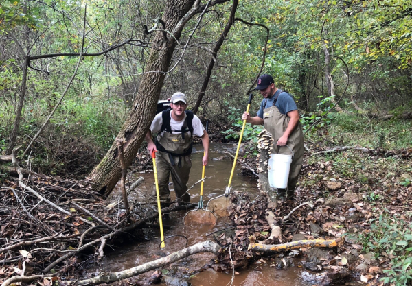 Electrofishing a stream with backpack equipment. Electrofishing a stream with backpack equipment.In what kinds of waters do you electrofish? Electrofishing takes place in freshwater and tidal freshwater rivers and streams. Because of the high conductivity of saltwater, it is not conducive to electrofishing. Can anglers use electrofishing equipment to catch fish? No, it is unlawful for the general public to use electrofishing equipment to catch fish. |
Category Archives: Conservation
Snook, Bass and Other Species Thrive in Florida Stormwater System
Hayley Rutger, Mote Marine Labs
from The Fishing Wire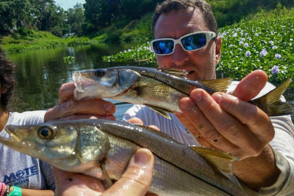 Mote’s Dr. Jim Locascio holds a juvenile snook from a Sarasota County canal. Credit: Dr. Nate Brennan/Mote Marine Laboratory
Dozens of fish species — including common snook and largemouth bass — use certain parts of the upper Phillippi Creek system, according to the first fish survey of this urbanized network of canals, retention ponds and wetlands in Sarasota County, Florida.
The survey — led by Mote Marine Laboratory and funded by Sarasota Bay Estuary Program (SBEP) — found the highest numbers and diversity of fishes around upper creek areas mimicking natural habitat: curving canals or ponds with wetland vegetation and sections of slower-moving water. Less naturalistic canals, with shorelines straightened for optimum drainage, generally hosted fewer fish of fewer species.
Urban waterways can lose ecosystem value — for example, ability to support economically important sport fish — due to pollution, altered water flow and loss of natural habitat. Scientists around the nation are investigating how to help these waterways better serve wildlife, ecosystems and communities. Phillippi Creek drains approximately 60 square miles (145 square kilometers) of Sarasota County land, with downstream waterways richer in natural habitat and upstream waterways bearing a clearer human fingerprint: more straightened, channelized canals, sediment traps and retention ponds.
“We want to understand how to balance the role of these waterways between stormwater management and ecosystem function,” said Mote staff scientist Dr. Jim Locascio. “Can upper Phillippi Creek be enhanced to benefit fish without sacrificing its performance as a drainage system? That’s what we hope our survey results will lead into. First we needed to learn how the system is functioning and understand whether some creek areas are more productive in supporting fish.”
“Typical stormwater drainage systems were designed to transport excess water directly from residential areas to the sea; this concentrates flow through a narrow area,” said Mote Staff Scientist Dr. Nate Brennan, who was also involved in the project. “Such systems can experience flash-flooding as well as very reduced flow, and they can transport nutrient-laden sediment downstream, all of which affects how many species can survive in the canals themselves and in downstream ecosystems such as estuaries and seagrass flats. However, slower and more consistently flowing waterways can be refuges with higher diversity of prey animals as well as high-value, predatory fish such as snook and largemouth bass. Upper Phillppi Creek is dominated by straightened canals, but it also includes good refuge areas and sites with potential to create more; that really interests us.”
Since the 1980s, Sarasota County has significantly enhanced its measures to prevent floods and enhance water quality, most commonly using wet ponds. Ponds help delay the discharge of runoff, capture sediments and protect downstream ecosystems. County officials and Mote scientists each want to know whether further enhancements will help support fisheries.
Based on discussions with Sarasota County and SBEP staff, Mote scientists surveyed fish and select invertebrates (such as shrimp) at about 70 sites – most along upper Phillippi Creek, north of Bahia Vista Street and east of Beneva Road, and one downstream from this junction: Red Bug Slough preserve. Sites represented three habitat types: canals with generally straightened shorelines maintained to drain storm water; secondary stage canals with more bent shorelines, restored wetland areas, a natural preserve and sediment traps; and retention ponds known as the Celery Fields.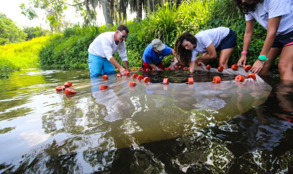 From left: Mote scientists Dr. Jim Locascio, Dr. Nate Brennan, and Greer Babbe use a seine net to survey for fish in Sarasota County’s stormwater canal system. Credit Conor Goulding/Mote Marine Laboratory.
“Canals are a common feature around Florida and around the world, which means the results of this study could be far reaching,” said John Ryan, Environmental Manager for Sarasota County’s Stormwater Environmental Utility. “Nature friendly drainage designs could add value to the lives of a great many people who live on the world’s coasts.”
During March-May and September-November 2016, Mote scientists and interns used purse seine nets to catch, identify, count and release fish and invertebrates, measuring a sample of them. The scientists documented temperature, salinity, dissolved oxygen and the presence or absence of vegetation.
In all, the researchers counted 36,136 fishes and invertebrates in 37 scientific groups. Overall, the most abundant species were the native eastern mosquitofish (scientific name: Gambusia holbrooki), which were 46.5 percent of all animals counted. Also abundant were non-native tilapia (Oreochromis spp., 13.3 percent), native grass shrimp (Palaemonetes spp., 11.5 percent), and native sailfin molly (Poecilia latipinna, 9.2 percent). Native blue killifish (Lucania goodei), native least killifish (Heterandria formosa), and native Seminole killifish (Fundulus seminolis) were semi-abundant.
The highest biodiversity sites — with the most species and the most evenly distributed numbers of animals in each species — were secondary stage canal habitats. Their complex curves, vegetation and flow patterns can mimic natural habitat. Less biodiversity was found at retention pond sites, followed by the least naturalistic sites: canals.
Common snook (Centropomus undecimalis) — a favorite Florida sport fish — were found at 15 sampling sites in seven areas. Among those areas, 61.6 percent of snook were in secondary stage canal habitats, especially two sediment traps. All snook were juveniles that had completed their larval, or baby, stage within the past two years.
“Of the juvenile snook we found, a notable number were in sediment traps, which are used to keep sediment from moving downstream but also appear to mimic the natural systems where the snook larvae settle and become juvenile fish,” Locascio said. “In wild tidal creeks, snook may settle in terminal ponds with reduced flow. Sediment traps may be creating similar habitat as a byproduct. However, we need to better understand how the snook are affected during maintenance, when the sediments are removed. This is one good opportunity for follow-up research.”
Largemouth bass (Micropterus salmoides) juveniles and/or adults were found at 30 sites in eight areas, with 69.2 percent in secondary stage canal habitats.
According to Mote’s report, “…secondary stage canal habitat which included preserves, sediment traps and restored wetlands were most important for snook and largemouth bass and maintained the highest levels of diversity.”
“Some engineered habitats are mimicking natural habitats and functioning as recruitment areas for these fish in upper Phillippi Creek,” Locascio said. “That is a very positive finding, and there is more that could be done if additional areas can be enhanced and then monitored through future surveys.”
Locascio continued: “Some fish-friendly enhancements might even save money; for instance, say you have an area that’s difficult and costly to manage. Why not use that as a habitat restoration site, ultimately improving conditions for fish and decreasing maintenance costs such as removing vegetation?”
Other recommendations from this report include:
- Build fish-friendly features resembling the current sediment traps but varying in design to enhance their appeal to snook and bass. Then follow up with a monitoring program and fish-tagging studies to determine which designs help support fish.
- Find even more options for fish-friendly upgrades at multiple scales along Phillippi Creek by applying the current results to a mathematical model published by others in 2015. If the model applies to Phillippi Creek fish habitat, it could provide a wealth of additional ideas for fish-friendly, waterway management.
- Make better use of non-native tilapia, which are abundant in the Celery Fields retention ponds but may not travel far due to weirs that limit water flow. It the weirs could periodically release a pulse of water — and tilapia — safely and strategically, those tilapia may provide additional food to native, predatory fish downstream.
“The next steps are exciting,” added Brennan, “because they can involve eco-engineering where we consider stormwater management goals but add components like ecosystem health and societal benefits. Places like stormwater canals that are often hidden from society can actually be transformed into attractive, productive urban ecosystems that improve property value and natural productivity.”
NC Study Indicates Some Fish are Caught Repeatedly–Possibly Skewing Population Estimates
| By North Carolina State University from The Fishing Wire A new study reports that, for several species of oceanic sport fish, individual fish that are caught, released and recaught are more likely to be caught again than scientists anticipated. A new study reports that, for several species of oceanic sport fish, individual fish that are caught, released and recaught are more likely to be caught again than scientists anticipated. The findings raise some interesting questions for policy makers tasked with preserving sustainable fisheries.The study makes use of data from tagging programs, in which researchers tag fish and release them into the wild. When those fish are caught, and the tag information is returned to the researchers, it can give scientists information that informs fishery policies. “Fisheries researchers who work in tagging programs have long noticed that certain fish seem to get caught repeatedly, and we set out to determine the implications of this phenomenon,” says Jeff Buckel, co-author of the study and a professor of applied ecology at North Carolina State University. To that end, researchers examined decades’ worth of Atlantic coast tagging datasets on four fish species: black sea bass (Centropristis striata), gray triggerfish (Balistes capriscus), red grouper (Epinephelus morio), and Warsaw grouper (Hyporthodus nigritus). Using a computational model, the researchers determined that—for the black sea bass and both types of grouper—survival was significantly higher after the second, third, and fourth release as compared to the first release. “Think of it this way,” says Brendan Runde, first author of the study and a Ph.D. student at NC State. “Let’s say you tagged 1,000 fish and recaptured 100 of them for a first time. After re-releasing those 100 fish, you would only expect to recapture 10 of them a second time. But that’s not what we’re seeing. We’re seeing much higher numbers of fish getting recaptured after the second time. “Our hypothesis is that this increase in catch rate stems from selection for robust individuals,” Runde says. In other words, because some fish don’t survive the first release, and you can’t catch a dead fish, the fish that were robust enough to survive their first encounter were more likely to survive following catch-and-release events. The finding could have a significant impact on stock assessments, which inform fishery policies. “One might assume that every catch and release in a recreational fishery is a unique fish,” Buckel says. “So that if 5 million black sea bass were caught and released in a given year, that would mean there were at least 5 million black sea bass in a fishery. For these three species of fish and likely many others, that’s just not true. At least some of those 5 million catches were the same fish getting caught over and over again.” “Reliable estimates of how many unique fish are released are critical to accurately assessing the health of the population,” says Kyle Shertzer, a co-author of the study and stock assessment scientist at NOAA Fisheries. “On the positive side, the study also suggests that for many species fish mortality from being released appears lower than we thought,” Buckel says. “For those species, if a fish survives its first release, it has an even better chance of surviving subsequent releases.” “We think that the issues raised by our findings are likely relevant for many marine fish stock assessments that rely on catch-and-release data—though this will vary based on the species and the details of how each stock assessment is performed,” Runde says. The paper, “Repetitive capture of marine fishes: implications for estimating number and mortality of releases,” is published in the ICES Journal of Marine Science. |
Angling–A Safe Haven During the Pandemic
| from The Fishing Wire Randy Zellers LITTLE ROCK — In the face of a global pandemic, Arkansans rediscovered their bond with nature and enjoyed angling more than they have in the last few years. Thanks to a recently completed study by Louisiana State University, scientists may have a few more answers into how to keep the momentum going. The study, led by Stephen Midway, Ph.D. at LSU’s College of the Coast and Environment, evaluated the effect of the pandemic on fishing license holders. Jessica Feltz, a human dimensions biologist who works for the Arkansas Game and Fish Commission’s Fisheries Division, coordinated the Arkansas portion of the survey, gathering contact information for Arkansas anglers who purchased a license between March and May of this year. “That was the period the research is focused on, because it was during that initial COVID response when schools and businesses closed or went to virtual options,” Feltz said. “That was when we noticed much more activity on lakes and rivers in Arkansas, but this research is important to verify what we saw.”Nearly 1,600 participants who were randomly selected from the AGFC’s fishing license database completed surveys.“ Dr. Midway set a goal of 1,000 survey responses for each state, so we do feel confident in our results,” Feltz said.Not only did more anglers purchase licenses, but those who historically purchased fishing licenses went more often. A review of license sales indicates an increase of 19.6 percent in purchases from March to May 2020 as compared to the same period in 2019, and survey responses show that 32 percent of anglers said they fished more than they would in a typical year. The average number of fishing trips taken during the initial COVID-19 response was 10.9 trips per angler. This time period also falls during one of the peaks of fishing activity in Arkansas. While many states saw massive shutdowns of boating accesses, boat ramps in The Natural State remained largely open. The only boating access points closed during the initial COVID-19 response were those on the Buffalo National River and any smaller ramps that were part of a local park that had been closed in response to the virus. Army Corps of Engineers boat ramps remained open as well as state park ramps and AGFC-owned ramps. Campgrounds in many areas were closed, which may have curtailed some plans for extended fishing trips. Three-quarters of respondents said they saw no change in their ability to go fishing as a result of any access closures, but some did indicate the initial closure of some public parks, campgrounds and boat ramps as an obstacle they needed to overcome during their fishing excursions. The increase in fishing activity may have been the result of the perception that fishing, by and large, presents a low-risk to catching the coronavirus that causes COVID-19. “This perception was confirmed by the survey, which indicated that 98 percent of the respondents said they felt fishing was at least a somewhat safe activity during the pandemic,” Feltz said. “It’s nice to know people felt fishing was something they could still enjoy during this time.”Feltz says it’s too early to tell if the same increase will occur in hunting this fall, but she says the information gained through the survey will help the agency plan outreach and goals for next year. “We are just moving forward with discussions on how we can retain these new anglers and anglers who have rediscovered fishing,” Feltz said. “In addition to notices and reminders on how to renew their license, we are hoping to encourage them to expand their outdoor experiences. Maybe take up trout fishing or travel to a new fishing destination in Arkansas for a fresh adventure. We historically have spent a lot of effort getting people to make that first step to becoming lifelong anglers, now we need to switch gears to keep them on that path.” Randy Zellers Assistant Chief of Communications, Arkansas GFD |
Chattooga River Conservation for Trout
| Text by Greg Lucas Photos by Taylor Main from The Fishing Wire 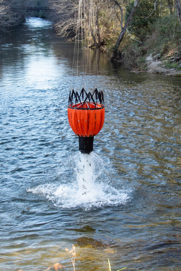 Watching an experienced team of fisheries biologists and volunteers work with a helicopter pilot to fill and drop brailer bags of trout in a remote river is a little bit like experiencing a ballet — lots of moving parts have to come together with just the right timing to make it all work. Watching an experienced team of fisheries biologists and volunteers work with a helicopter pilot to fill and drop brailer bags of trout in a remote river is a little bit like experiencing a ballet — lots of moving parts have to come together with just the right timing to make it all work.Chattooga, Wild and Scenic River. The very words conjure up all sorts of images. If you have done a bit of whitewater paddling in the region, the Chattooga’s roaring sound pouring over and around boulders is sweet music to your ears. It is one of the longest and most spectacular free-flowing mountain rivers in the Southeast, cascading some 50 miles from its headwaters in North Carolina to the state line between South Carolina and Georgia. But if you are a fly fisherman, or fisherwoman, or, heck, fly ANGLER, then you know the upper reaches of the Chattooga River as something special, particularly in the State of South Carolina, where we are not as blessed with trout waters as our neighboring states of Georgia and North Carolina. For it is a place where an angler can get lost in thought, lost in the music and rhythms of a river that is truly Wild and Scenic, like no other in the Palmetto State. And thanks to an amazing partnership between the South Carolina Department of Natural Resources (SCDNR), the Georgia Department of Natural Resources, the U.S. Forest Service, and Trout Unlimited, large numbers of rainbow, brook and brown trout are stocked in the upper portions of the Chattooga River once a year, a helicopter gently laying them in backcountry areas too remote to easily be reached by vehicle. On Nov. 2, an 11-mile backcountry reach of the Chattooga River was stocked. The Chattooga, which for a good distance forms the border between South Carolina and Georgia, was the United States’ first Wild and Scenic River, designated as such in 1974. The Wild and Scenic designation resulted in the closure of most of the access roads used for trout stocking in this 11-mile section, and that’s the reason the helicopter stocking effort started. The first helicopter trout stockings of this part of the Chattooga began about 50 years ago, and this program has been refined considerably over time. The Chauga River in Oconee was similarly stocked with trout by helicopter on the next day, Nov. 3. “We want trout anglers to have the experience of fishing in this remote and beautiful Wild and Scenic River,” said Dan Rankin, SCDNR Upstate regional fisheries biologist. “But we also want to give them a reasonable chance for success.” The trout fishery in this 11-mile segment of the Chattooga River is largely supported by stocking hatchery trout reared by SCDNR at Walhalla State Fish Hatchery, and by Georgia DNR at Burton State Hatchery. 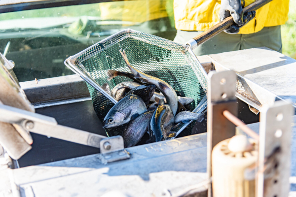 Trout begin their journey in an aerated truck, then are transferred to a helicopter “bucket” for stocking. Trout begin their journey in an aerated truck, then are transferred to a helicopter “bucket” for stocking.These partner agencies and organizations—SCDNR, U.S. Forest Service, Georgia DNR and Trout Unlimited–have worked together as the “Chattooga River Fisheries Coalition” since 1986 to improve the trout fishery. “We are stocking two different ‘management units’ of the Chattooga River by helicopter,” said Rankin. “One two-and-a-half-mile reach is the ‘Delayed Harvest’ area, and the eight-and-a-half-mile upper reach of the ‘Rock Gorge/Big Bend’ area has different regulations from the Delayed Harvest Area.” Delayed Harvest, according to Rankin, is a “fish-for-fun” reach where catch-and-release with single-hook artificial lures is required Nov. 1–May 14 of each year. This stretch reverts to general fishing regulations (5 trout daily limit, no tackle restrictions) from May 15-Oct. 31. The helicopter stocked about 2,500 adult trout (10-plus inches) of rainbow, brown, and brook trout in this section. The Rock Gorge section of the Chattooga River, which is considered a backcountry area, has no tackle restrictions and a 5-trout daily limit year-round. During the Nov. 2 helicopter stocking, SCDNR stocked 15,000 sub-adult (6-inch) brown trout and 1,000 adult brown trout (10-plus inch) in this segment. Georgia DNR will helicopter stock about 10,000 rainbow trout at a later date. “The idea,” Rankin said, “is that some of these smaller brown trout, and then later the rainbow trout from Georgia DNR, will survive next summer and grow out to a nice size for anglers.” Watching the gathering of equipment at Russell Bottoms, alongside SC 28 just before the bridge that leads to Georgia, is quite a spectacle. Dozens of trucks are lined up in a row, with people alternately running helter-skelter around the field (when the helicopter sets down the “Bambi Bucket,” to be filled with trout) and then standing around for long chunks of time while the chopper delivers its load to a remote section of the Chattooga River. Scenes like this are likely the genesis of the phrase “Hurry Up And Wait,” which is so appropriate for any gathering of government employees, whether it be fisheries biologists or infantry soldiers. Completing the scene is that everyone is wearing many articles of Personal Protective Equipment (PPE), which includes a hard hat, eye protection, face coverings/masks, closed-toe shoes (leather boots preferable), gloves, and green and yellow fire-resistant Nomex pants and shirts. The Forest Service is very diligent about PPE, not surprisingly, since being in close proximity to a helicopter is dangerous work. There is zero cell coverage at the site, which makes coordination a real challenge. 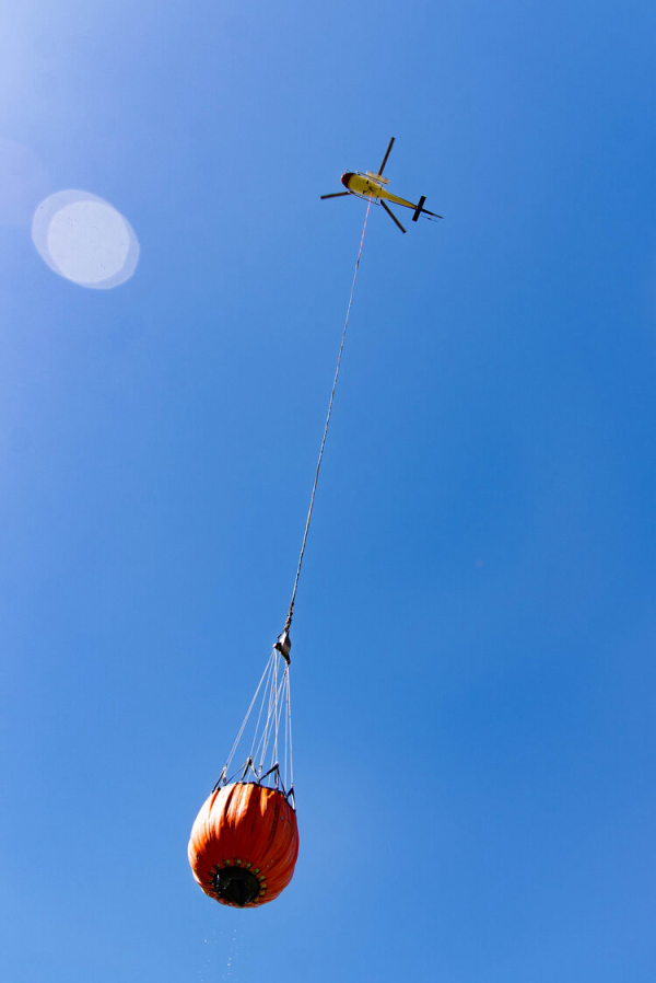 The helicopter makes quick work of ferrying the load of trout to the remote stretches of the river. The helicopter makes quick work of ferrying the load of trout to the remote stretches of the river.The helicopter was already on the scene when SCDNR videographer/photographer Taylor Main and I arrived around 8:20 a.m. Keith Whalen, Forest Service fisheries biologist, got Taylor suited up in all the appropriate PPE, and after the safety briefing (mandatory if you are going to get near the helicopter while the fish are being loaded), Taylor began what would be many hours of photography and videography. Over and over, she captured SCDNR Freshwater Fisheries staff netting trout from the hatchery truck into two 50-gallon plastic buckets, then carrying them to the helicopter’s “Bambi Bucket,” which was at the end of a 150-foot line. The bucket was already “watered,” and SCDNR staff poured the trout into the bucket, the chopper lifted off, and away it went. The trout are bound for the Wild and Scenic Chattooga River, the river that runs through South Carolina and Georgia, and the anglers who will pursue them. |
Industry-funded Research on Dorsal Spine Aging Shows Promise in Largemouth Bass Conservation
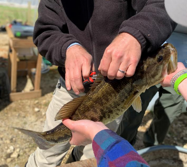 Craig Springer, USFWS – Wildlife and Sport Fish Restoration from The Fishing Wire There are “lumpers” and there are “splitters.” Some fisheries scientists think that largemouth bass and Florida bass should be split into two species. Others lump them together as one species as mere diverging strains or races. This much can be agreed upon: bass in southern climates grow big, and fishery managers are careful to conserve the trophy fish coveted by anglers at all experience levels. To that end, Summer Lindelien, a fish biologist with the Florida Fish and Wildlife Conservation Commission has endeavored the last four years to learn more about how Florida’s largemouth bass, Florida bass, and their hybrids grow over time. Excise taxes paid by fishing tackle manufacturers and on motor boat fuels fund her research in grants administered by the U.S. Fish and Wildlife Service’s Wildlife and Sport Fish Restoration Program. The research is bearing fruit that promises to yield better bass fishing in Florida—if not anywhere the 19 species and subspecies of the black bass family swim. More research is in the works and necessary to take further steps. Lindelien and her FWC colleagues are developing a new method to determine age and growth rates of trophy largemouth bass that would otherwise be missing in population assessments and ultimately, fishing regulations. Hard bony structures are best for determining a fish’s age, body parts such as scales and ear bones that put down rings at each year of growth. The latter is most reliable but there is a downside: it is 100 percent lethal. Dorsal spines may be the alternative. The method shows great promise as Lindelien learned while a graduate student at the University of Florida. She and her colleagues also completed a six-waterbody study to refine the efficacy of reading age rings on dorsal spines and are in the midst of evaluating how dorsal spine aging error affects population dynamic metrics. Lindelien and colleagues caught wild bass known to be hybrids of largemouth and Florida bass, 36 fish in all, varying size from 12 to 22 inches long. Six bass each were acclimated in six tanks and three from each tank where randomly picked to have three dorsal fin spines extracted with surgical scissors and snips cut flush with the bass’s back. The fish were monitored for injury and mortality for 35 days afterward. 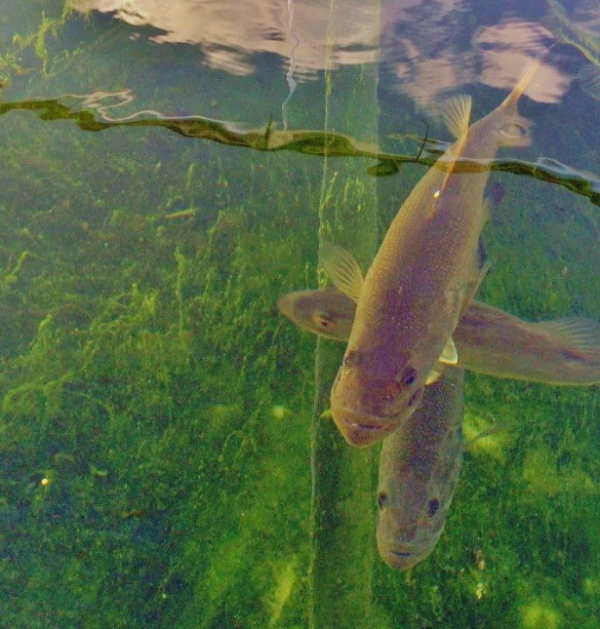 None of the bass with missing spines perished. Overall condition between fish with spines intact and those with spines removed did not vary to any great degree at the conclusion of the month-long study. In the end, the method shows much utility as a means for black bass fishery managers to gather more data on trophy fish without deleterious effects on the fish and the fish population. The method also holds promise down the road for citizen-scientists—anglers, that is—to weigh and measure and trim a spine before releasing trophy fish, thus greatly expanding the essential data scientists need. None of the bass with missing spines perished. Overall condition between fish with spines intact and those with spines removed did not vary to any great degree at the conclusion of the month-long study. In the end, the method shows much utility as a means for black bass fishery managers to gather more data on trophy fish without deleterious effects on the fish and the fish population. The method also holds promise down the road for citizen-scientists—anglers, that is—to weigh and measure and trim a spine before releasing trophy fish, thus greatly expanding the essential data scientists need.Lindelien is the first to confirm that removing dorsal spines is benign to largemouth bass. According to Lindelien, as the dorsal spine aging technique is refined it might be employed on other black basses, common and otherwise: Guadalupe bass in Texas, spotted bass in Kentucky, Neosho smallmouth bass of Oklahoma or the rarer Choctaw bass of Alabama and Florida where removing fish of any size is not an option. Lindelien and her colleagues published the results of the spine extraction research in the U.S. Fish and Wildlife Service’s Journal of Fish and Wildlife Management.– |
Habitat Connectivity Helps Trout Take Care of Themselves
Trout Unlimited’s Poose Creek Project in Colorado served as an opportunity to test, validate and perhaps even contribute toward a framework of knowledge around fish passage and habitat connectivity.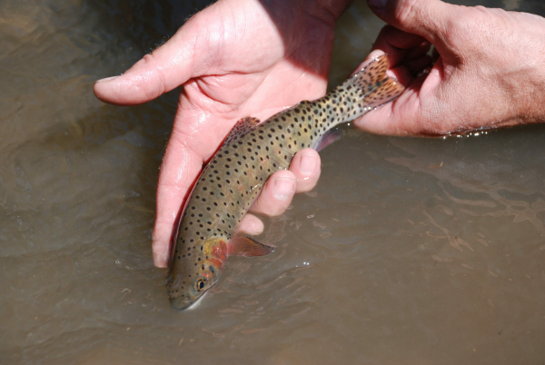 Colorado River cutthroat trout like this one didn’t take long to use a fishway on Poose Creek in Colorado. Colorado River cutthroat trout like this one didn’t take long to use a fishway on Poose Creek in Colorado. Brian Hodge/Trout Unlimited By Brian Hodge, Trout Unlimited from The Fishing Wire In our work at Trout Unlimited, we often rely on scientific theory to plan and implement conservation projects. In some instances, we also test hypotheses by monitoring projects and comparing predictions with outcomes, and in doing so contribute towards the broader body of scientific theory. For TU and our local agency partners, the Poose Creek Project in Colorado served as an opportunity to test, validate and perhaps even contribute toward a framework of knowledge around fish passage and habitat connectivity. When TU and its partners sampled the headwaters of Poose Creek in 2012-2013, native Colorado River cutthroat trout were almost completely absent from the reach above the one road-stream crossing but relatively abundant in the reach below the crossing. 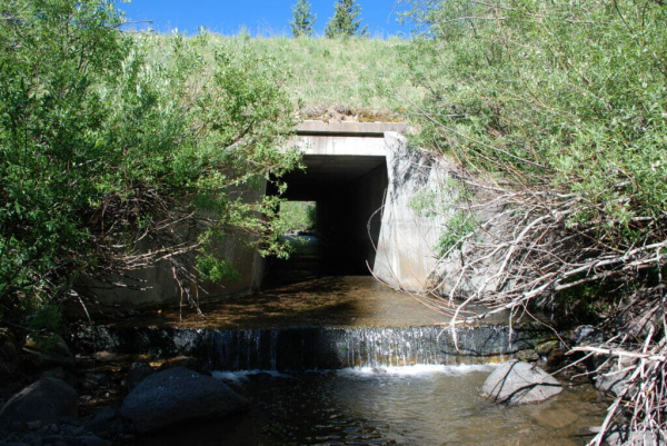 A 108-foot long, concrete culvert and apron were installed at Poose Creek in the 1960s. Brian Hodge photo. Moreover, at long-term monitoring stations upstream and downstream of the culvert, cutthroat densities were 0 and approximately 437 fish per mile, respectively. This contrast confirmed a standing assumption that the box culvert under the road was, and had for decades been, a complete fish passage obstacle. In 2014, TU and the U.S. Forest Service retrofitted the box culvert with a vertical slot fishway, also known as a fish ladder. Although we only designed the fishway to pass adult trout (which are better swimmers and jumpers than their juvenile counterparts), our ultimate goal was to facilitate repatriation by the native cutthroat above the culvert. 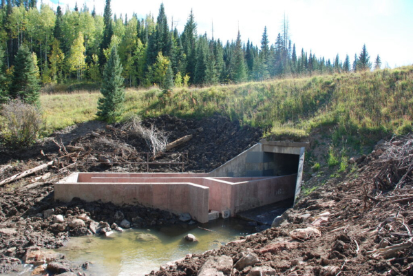 The exiting culvert was retrofitted with a vertical slot fishway in 2014. Brian Hodge photo. The exiting culvert was retrofitted with a vertical slot fishway in 2014. Brian Hodge photo.The fishway project was thus rooted in at least two testable hypotheses: one, that removal or mitigation of the passage obstacle would actually result in fish passage; and two, that the incursion of adult spawners into vacant habitats would result in recolonization by the species (in other words, a few fish would ultimately lead to a lot of fish). Meanwhile, we had much to learn about the effectiveness of fishways for restoring passage to inland (nonanadromous) fish. 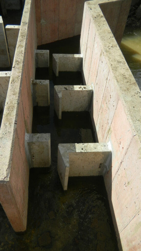 Slotted baffles in the 150-foot long fishway allow fish to swim up the ladder. Brian Hodge photo. Slotted baffles in the 150-foot long fishway allow fish to swim up the ladder. Brian Hodge photo.In 2015 and 2016, we teamed up with Colorado Parks and Wildlife to evaluate the first hypothesis — that the fishway would effectively restore fish passage. We captured cutthroat in the mile of stream below the culvert and injected them with passive integrated transponders, or PIT tags. We then used a series of antennas within and around the fishway to monitor the number of approaches to, attempts at, and successful trips through, the fishway. The result? Cutthroat trout began using the Poose Creek fishway within a year of its construction. In fact, the fishway was completed in fall of 2014 and the inaugural trips through the structure coincided with the spring spawning season of 2015. Approximately 4 percent of all PIT-tagged trout approached the fishway, and 100 percent of the fish that approached it succeeded in entering and passing the new structure. These findings, available here, satisfied our first goal of restoring passage. Nevertheless, questions still remained about the ultimate effect of restoring connectivity. 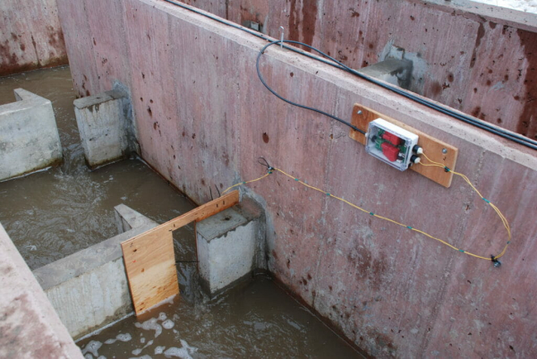 One of four stationary antennas installed in and around the fishway. Brian Hodge/Trout Unlimited One of four stationary antennas installed in and around the fishway. Brian Hodge/Trout UnlimitedIn fall of 2020, approximately one and a half to two cutthroat trout generations after the fishway was installed, we tested the second hypothesis— that restoring fish passage would lead to recolonization of upstream habitats. Specifically, we used backpack electrofishing units to survey a half-mile segment of stream immediately above the culvert, and to repeat a multiple-pass population estimate at the long-term monitoring site (located approximately 0.6 miles upstream of the culvert). In 2012, the segment of the stream was vacant of cutthroat trout. In 2020, the same segment hosted at least 589 cutthroats. Similarly, the same long-term monitoring station that contained cutthroat at a density of 0 fish per mile in 2012 contained cutthroat at a density of approximately 2,752 fish per mile in 2020 (817 fish per mile excluding the 2020 year-class). Just as importantly, the presence of multiple age classes, and of young-of-year fish in particular, confirmed that Colorado River cutthroat trout were spawning in and recruiting to the headwaters of Poose Creek. Of course, we can’t rigorously measure the percentage increase in cutthroat abundance above the fishway because the native salmonid was absent from the long-term monitoring site in 2012. Yet, even without the numbers, we might all recognize the indicator of success. 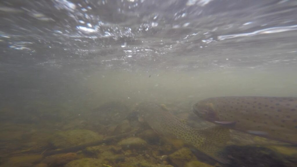 Colorado River cutthroat trout make their way to spawning grounds. Brian Hodge/Trout Unlimited Colorado River cutthroat trout make their way to spawning grounds. Brian Hodge/Trout UnlimitedIn the end, our findings at Poose Creek offered support of theory:If we do our part to remove migration obstacles from rivers and streams, the fish will take care of the rest. The benefits could be immeasurable. Brian Hodge is the Northwest Colorado Director for Trout Unlimited’s Western Water and Habitat program. |
Restoration Brings Salmon, Anglers Back to California’s Clear Creek
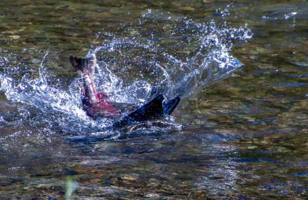 A male Chinook salmon, with red coloration, strikes another male Chinook on Clear Creek in Redding, California, during spawning season in October. Credit: Brandon Honig/USFWS By Brandon Honig, USF&W A male Chinook salmon, with red coloration, strikes another male Chinook on Clear Creek in Redding, California, during spawning season in October. Credit: Brandon Honig/USFWS By Brandon Honig, USF&WClear Creek has been transformed multiple times in the past two centuries, but the transformation of the past few decades was designed to last. Ravaged first by gold-seekers and then by gravel-miners, the Sacramento River tributary is today a haven for fish and people alike.“You get to see big male salmon chasing each other away from females and see females digging redds, or nests. It’s exciting,” said U.S. Fish and Wildlife Service biologist Charlie Chamberlain. “It’s something a lot of people would not expect to see in California except on National Geographic.” 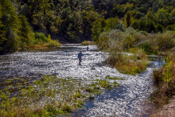 Local fishermen search for steelhead in Clear Creek, where restoration has created diverse conditions and habitats for fish. Credit: Brandon Honig/USFWS Local fishermen search for steelhead in Clear Creek, where restoration has created diverse conditions and habitats for fish. Credit: Brandon Honig/USFWSThirty years ago, it wasn’t something you’d see in Clear Creek either. There was little water flowing, and Saeltzer Dam closed off more than 11 miles of potential habitat for sensitive species like Central Valley steelhead and spring-run Chinook salmon. The Bureau of Land Management, however, acquired most of the Lower Clear Creek channel bottom in a series of deals in the 1990s. At the time, the creek was mainly known as an out-of-the-way place for illegal trash dumping and suspicious activity. “Some smart people at BLM understood Clear Creek’s potential for restoration, and they got a good deal on it because it was an industrial wasteland,” said biologist Derek Rupert, who oversaw the final phase of the project for the Bureau of Reclamation. “They made some good choices, so now the public owns the majority of this land.” Planning a partnership In 1992, Congress passed a massive fish and wildlife restoration program for California, the Central Valley Project Improvement Act. Among other measures, it singled out Clear Creek for an overhaul to be funded jointly with the state. The planning process involved a large group of landowners, stakeholders, consultants and agency experts, which delivered a multi-pronged approach. The plan would reconfigure part of the creek channel, raise the water level, open up areas for fish habitat and increase the stream’s complexity and food production. “My hat’s really off to those people who were involved in the late 1990s,” said Tricia Bratcher, a habitat restoration coordinator for the California Department of Fish and Wildlife, who joined the Clear Creek Technical Team in 2001. “They really put in some good thought on what restoration should look like, how it would function and the goals associated with all of that.” Before the work began, she said, Clear Creek looked “trashed.” There were pits and piles of dredger tailings everywhere, and the water was shallow and warm, with virtually no riparian vegetation. Reports of people lurking there also kept locals away. To clear the way for the restoration program, the Shasta County Sheriff’s Office teamed with the state and BLM rangers to tighten security and clean up Clear Creek. As the restoration work progressed, residents saw trails, restrooms and parking lots installed. “Now when we go out there, there are families utilizing the area, swimming with kids, fishing, mountain biking, hiking with dogs,” Chamberlain said. “That greenway vision BLM had is being realized.” A food-based explosion Restoration began by increasing water flows through Reclamation’s Whiskeytown Dam, then removing the privately-owned Saeltzer Dam. Those steps brought fish to Clear Creek in the thousands, but the stream was nothing like its former self. 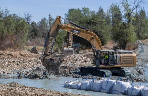 Workers plug a ditch dug by gravel-miners last century and redirect its water into a new channel on Clear Creek’s original path. Credit: Brandon Honig/USFWS Workers plug a ditch dug by gravel-miners last century and redirect its water into a new channel on Clear Creek’s original path. Credit: Brandon Honig/USFWS“Miners basically dug a ditch here along the valley and diverted the creek into it so they would have room for gravel extraction,” Chamberlain said of one part of the restoration area. “They took a creek that used to have this dynamism to it and serve a lot of ecological functions, then dumped it into a little chute where it had very little ecological function and no dynamism. ”Creeks are naturally complex. They change speed and direction, pull in branches and move sediment. That action creates gravel bars, riffles and side channels, which foster plant and insect growth. The channel the gravel-miners dug, on the other hand, was like a swiftly moving canal that only eroded downward. It didn’t change over time, and it didn’t create much habitat. The restoration plan called for filling in the miners’ ditch and restoring the creek’s original path. It also required lowering the floodplain to create longer-lasting habitats and nourishment for rearing fish. “If you change the shape of the creek so it spreads out and trickles into the floodplain or side channels, you get extra-slow areas where you’ve wet new surfaces, and those floodplains generate a lot of fish food and grow vegetation,” Chamberlain said. “You get a food-based explosion.” Workers have placed downed trees and more than 180,000 tons of gravel in Clear Creek since the 1990s to help create habitat. Salmon spawning habitat was the original focus, but the work has created diverse conditions that benefit fish in multiple life stages. The latest phase focused on juvenile salmon, but will also provide homes for beavers, song sparrows and pond turtles. “For juvenile fish, woody debris provides refuges from predators and spots to hold and wait for food to float, swim or fly by,” said Matt Brown, who managed the Fish and Wildlife Service’s program on Clear Creek from 1995-2017. “There will also be areas for adult fish to hang out and rest before they spawn and other areas with good spawning habitat.” A long-term commitment The 2.2-mile Lower Clear Creek Floodway Rehabilitation Project took more than two decades to complete. Along the way, the multi-agency Technical Team overcame challenge after challenge, culminating in completion of the final stage in October. “I’m proud of the work that came before me and the perseverance they showed,” said Chamberlain, who has worked on the project since 2015. “People aren’t always resilient enough to insist that, ‘there’s a great opportunity here,’ even when the naysayers can’t see it. A vision was implemented here, and it’s working.” 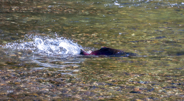 A Chinook salmon swims in Clear Creek during spawning season in October. Restoration work that began in the 1990s has turned Clear Creek into a salmon-producing hotspot. Credit: Brandon Honig/USFWS A Chinook salmon swims in Clear Creek during spawning season in October. Restoration work that began in the 1990s has turned Clear Creek into a salmon-producing hotspot. Credit: Brandon Honig/USFWSIn addition to the Service, Reclamation and the state, the project received significant contributions from National Oceanic and Atmospheric Administration Fisheries, the National Park Service, California Department of Water Resources, the Yurok Tribe and a variety of local organizations including the Western Shasta Resource Conservation District. The experience often felt like a marriage, Bratcher said. “Sometimes it drives you crazy, but you love the place, so you work through the problems and will be stronger for it,” she said. “We’ve had some really good people, some really knowledgeable people, who have continued to stick it out and really love Clear Creek.”Also like a marriage, she said, the commitment to Clear Creek should be eternal.“I’d hate for people to say, ‘We’re done on Clear Creek,’” Bratcher said. “Any time you implement a change, it disrupts the patterns and you have a responsibility. You are beholden to watch over it and be a steward.” 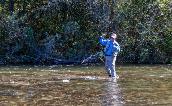 Creighton Smith of Redding tries to pull a steelhead out of Clear Creek in October. Wild steelhead must be released unharmed when caught in California. Credit: Brandon Honig/USFWS Creighton Smith of Redding tries to pull a steelhead out of Clear Creek in October. Wild steelhead must be released unharmed when caught in California. Credit: Brandon Honig/USFWS |
Record Lake Champlain Lake Trout a Testament to Successful Sea Lamprey Control
The jumbo trout had no sea lamprey scarring despite a long life in a lake once heavily infested–lamprey control efforts have clearly been effective.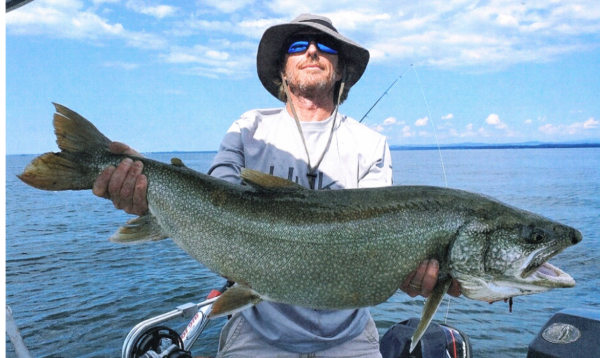 By John Hall, Vermont Fish & Wildlife Department By John Hall, Vermont Fish & Wildlife Departmentfrom The Fishing Wire The Vermont Fish and Wildlife Department recently certified a record fish entry for a 19.36-pound lake trout caught in Lake Champlain in August. Department officials say this demonstrates the positive impact long-term sea lamprey control efforts are having on the lake’s quality fishing opportunities. Angler Jeffery Sanford, of South Burlington was fishing alone the day he jigged up the 36.5-inch lake trout from over 100-feet of water. “I just got my first boat this year, and it was my first time out alone,” recounted Sanford. “It hit on my first cast of the day. Once I netted it and got it in the boat I was astounded at its size and lack of any lamprey scars or wounds.” Sanford said he wanted to release the lake trout alive but was unable to revive the fish, so he brought it in to be weighed officially as part of Lake Champlain International’s Basin Derby, and he also entered it into the Fish and Wildlife Department’s record fish program. The fish currently sits in first place for the derby’s lake trout category. According to department fisheries biologist Shawn Good, who oversees the Vermont State Record Fish Program, Sanford’s catch is a reason for celebration. “Jeff’s fish is the largest lake trout from Lake Champlain entered in the Record Fish Program since the department started keeping fish records in 1969,” said Good. “There have been much larger lake trout caught in other Vermont waters, but this Champlain fish is a big deal.” According to Good, it is a direct result of good lake trout habitat in Lake Champlain and ongoing sea lamprey control efforts. In Lake Champlain, nuisance sea lamprey prey on lake trout, landlocked Atlantic salmon, brown trout, steelhead, walleye, lake sturgeon, and other fish species. High attack rates and sea lamprey wounds can result in lower growth, smaller size, shortened life expectancy, and decreased fishing opportunities. To counter this, the Lake Champlain Fish and Wildlife Management Cooperative, comprised of the Vermont Fish and Wildlife Department, the New York Department of Environmental Conservation, and the U.S. Fish and Wildlife Service, initiated an experimental sea lamprey control program in 1990. A long-term control program that began in 2002 continues today. Sanford’s observation of no sea lamprey wounds on his record catch is significant, says Good. “We’re seeing lower overall wounding rates on many of these fish, and the fact that anglers are catching older, larger lake trout, salmon, and other fish species is proof that continued long-term sea lamprey control is working, and resulting in improved fishing opportunities on Champlain.” Elizabeth Ehlers, Tournament Director of the LCI Fishing Derbies, says the annual Father’s Day Derby and year-long Basin Derby have seen bigger and bigger fish in recent years. “There’s been an upward trend in size for many of the species entered in our derbies. Over the past 10 years, we have seen several record-breaking fish in cold, cool and warm water species divisions.” “While our anglers are incredibly dedicated and skilled, these catches are not just by chance or luck. The Vermont Fish and Wildlife Department has worked tirelessly to protect and restore the Lake Champlain fishery. Their management efforts – including lamprey treatment, control of invasive species, and fish stocking – have benefited all who enjoy this resource. The impact of their efforts extends far beyond the angling community, as Lake Champlain anglers contribute over $200 million dollars annually to local economies.” Jeff Sanford says he’s grateful for the fishery that continues to improve on Lake Champlain. “It was an amazing fish and quite the battle. I’m extremely excited for next season! We have such an incredible fishery here.” Sanford says he credits the openness of other anglers in the lake’s fishing community with helping him catch the lake trout and becoming a better angler. “I just learned how to jig for lake trout this year from friends like Will Nolan, Ryan Carpentier and Jamie Shiekone. They provided the mentorship and tutelage I needed to learn a new technique. Everyone’s so open and friendly, and willing to help you learn something new.” Good says that is heartening to hear. “To maintain and grow participation in the sport we all love, it takes a village. I’ve always encouraged avid anglers to take newcomers out and show them the ropes. It can be challenging for a new angler to learn techniques that will help them be successful. I hope more anglers step up and become mentors to friends, family, even strangers.” This fall, the Lake Champlain Fish and Wildlife Management Cooperative is conducting sea lamprey control treatments on four Vermont rivers containing spawning populations of sea lamprey. The Winooski River was treated on October 2, the LaPlatte River will be treated on October 14 or 15, and control treatments will take place on the Lamoille and Missisquoi rivers within the next month. To learn more about Lake Champlain’s sea lamprey control program, visit: https://www.fws.gov/champlainlamprey |
Join Ducks, Unlimited for Conservation
When I bought my dream property, 75 acres of woods with two small ponds and a tiny field in east Spalding County, I wanted to manage it for wildlife and timber. The Georgia Forestry Commission worked with me to set up a conservation plan that I have tried to follow.
On the two small ponds I erected wood duck nest and put floating goose nests in the water. I loved watching a pair of geese use the nest, protect it from other geese and lay their eggs. It was a pretty sight to see the geese with their young paddling around until the young ones could leave.
Going to the ponds early in the morning or late in the afternoon I could hear the whistle of wood ducks as they flew in or out. One spring I saw a hen with about a dozen ducklings following her around on a pond and one fall a small flock of hooded mergansers took up residence and they were very pretty, too. Although I have never fired a shot at a duck, I enjoy them on my ponds and try to give them a good place to live and nest.
Conserving my land and water is multiplied millions of times all over North America by Ducks, Unlimited. This conservation group works tirelessly to conserve wetlands and increase wildlife and bird habitat. And many individual members, like me, work to do a small part in addition to the big projects the organization does.
The Ducks, Unlimited motto “Filling the skies with waterfowl today, tomorrow and forever” has been its purpose since its founding in 1937. Started by a small group of hunters, Ducks, Unlimited has grown to about 650,000 members in the US, 120,000 in Canada and 5000 in Mexico.
As of January 1, 2020, Ducks, Unlimited has conserved more than six million acres in the US, more than six million acres in Canada and two million in Mexico. Total acreage in North America is almost 15 million acres.
In addition, there is about 175 million acres that have been conserved through legislation and agreements that Ducks, Unlimited has had an influence on being enacted through working with governments and individuals. That is a tremendous amount of land to be brought under conservation to protect the future of waterfowl and wildlife.
Much of the efforts of Ducks, Unlimited is in Canada and the northern Midwest where they either buy land and protect it or work with state wildlife departments and individuals to conserve wetlands where ducks nest and raise their young.
But Ducks, Unlimited works in every state in the
US, including here in Georgia. And the projects do not just help ducks. Every kind of wildlife and birds use the land and are able to increase their numbers.
Here in our state, more than 27,000 acres have been conserved. Georgia is important because we are part of the Atlantic Flyway and waterfowl that nest in the prairies, Great Lakes and eastern Canada winter here.
Our coastal marshes and wetlands are important habitat for diving ducks like lesser scaup and paddle ducks like green wing teal and wigeon. Inland, wetlands and beaver ponds on major rivers host thousands of mallards and wood ducks. Lakes host ring-neck ducks, canvasbacks and wood ducks. Private ponds and wetlands like mine help those species, too.
From the Rhett’s Island Unit on the Altamaha Wildlife Management Area on the coast to the Blanton
Creek Wildlife Management Area near us, projects all over our state offer hunting, public recreation like birding and hiking, water quality improvement and natural habitat improvement.
Most of the work in Georgia consists of water control structures, like small dams to increase the amount of water in an area to dikes with pumps where fields can be drained, planted with food crops then flooded when they are mature to provide food for waterfowl.
Many of the projects done by Ducks, Unlimited are in conjunction with state agencies like the Georgia Department of Natural Resources and private companies like Georgia Power. Ducks, Unlimited members volunteer to do manual labor to help with these projects, too.
Many organizations spent a high percentage of the money they raise for “administration,” with only a small amount going to the efforts for which it was raised. Ducks, Unlimited dedicates 82 percent of their raised money to projects and only four percent to administration. About 14 percent goes to fundraising.
Membership fees and donations, and donations from businesses, are a big part of their income, but much of the money comes from local events. Banquets held all over Georgia offer a good meal, good fellowship and a chance to bid on items offered for auction. These events are a lot of fun and provide a large part of Ducks, Unlimited income.
Locally, the Pike County Chapter event was honored with President’s Roll of Honor award for the amount of money raised. You can go to https://www.ducks.org/georgia/events to see the many events scheduled around Georgia during November and early December. Many more will be held next year. For a fun night out, plan to attend one.
Help this great organization by joining – right now you get a nice sweatshirt type fleece jacket just for paying membership dues. And if you have land, manage it for waterfowl and wildlife. Help out Ducks, Unlimited, the Georgia Department of Wildlife, businesses and other individuals by doing your part for the future of our natural environment.